
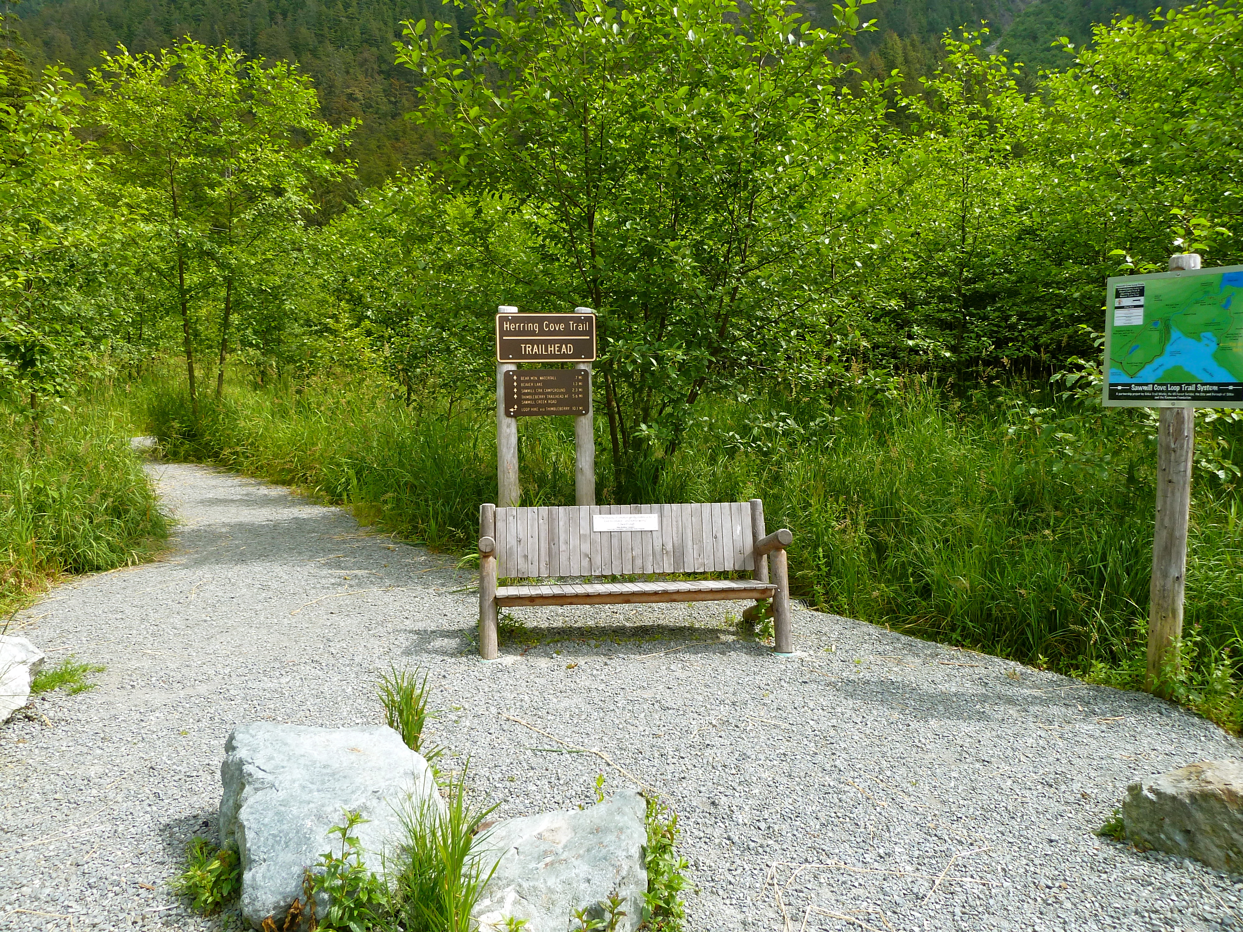
- USE : Hike
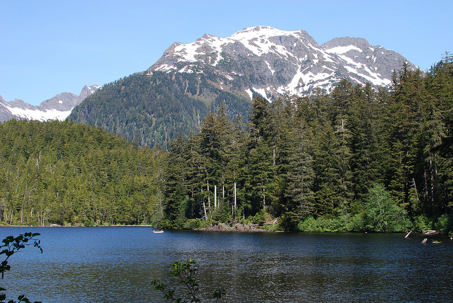
- DESCRIPTION : Popular trail well suited to family outings. Views of nearby rugged mountains, wildlife and muskeg.
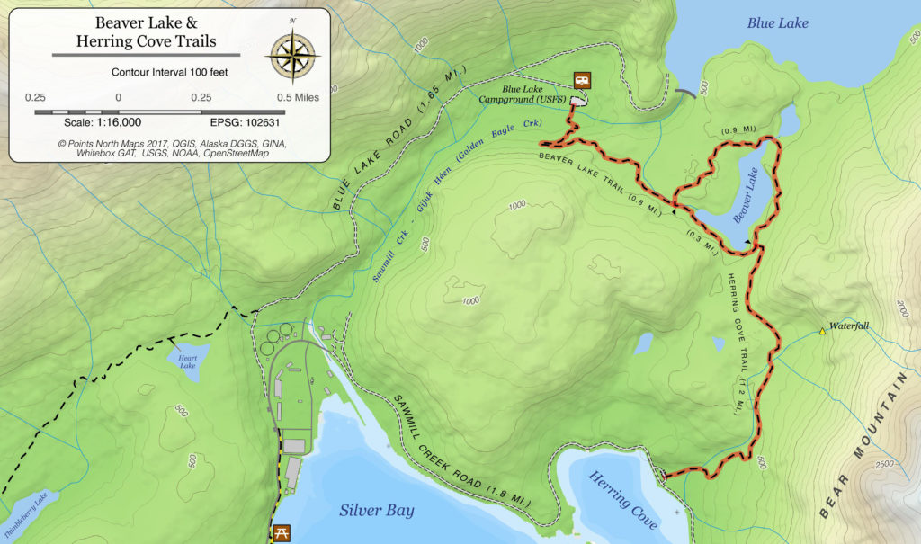
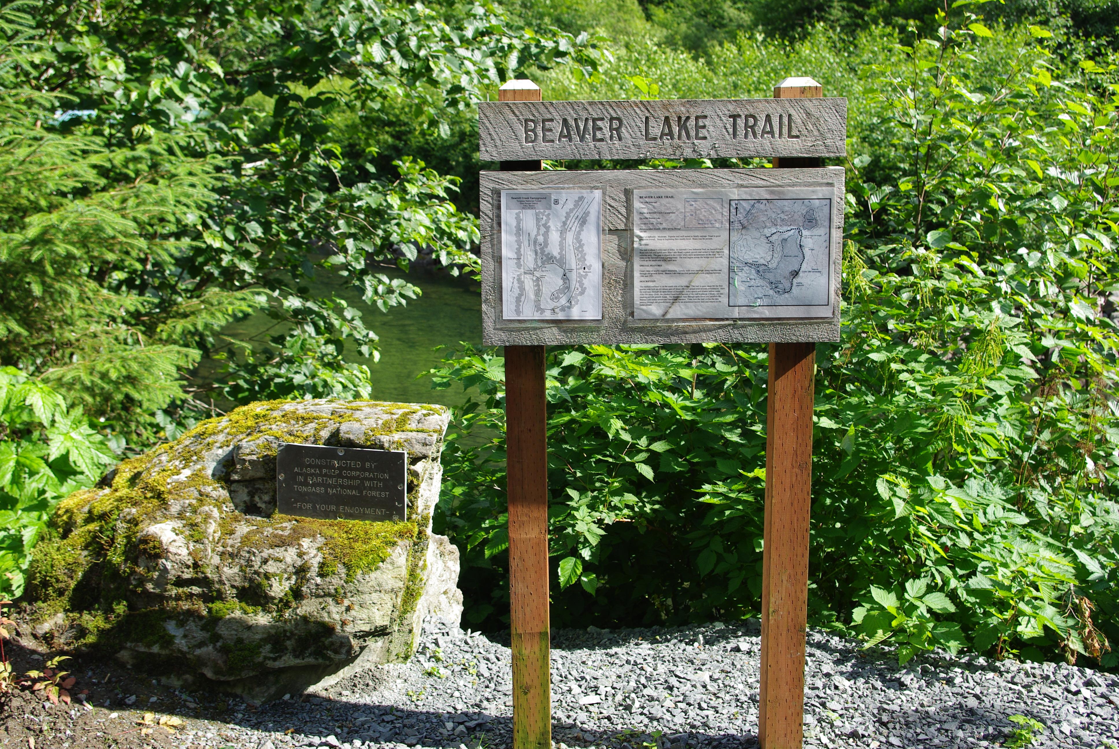
- TWO TRAILHEADS : One at the steel bridge at Sawmill Creek Campground off Blue Lake Road and the other is the Herring Cove Trailhead. Blue Lake Road is typically open to vehicle traffic April-November. Call the City and Borough of Sitka at (907) 747-1800 for road updates.
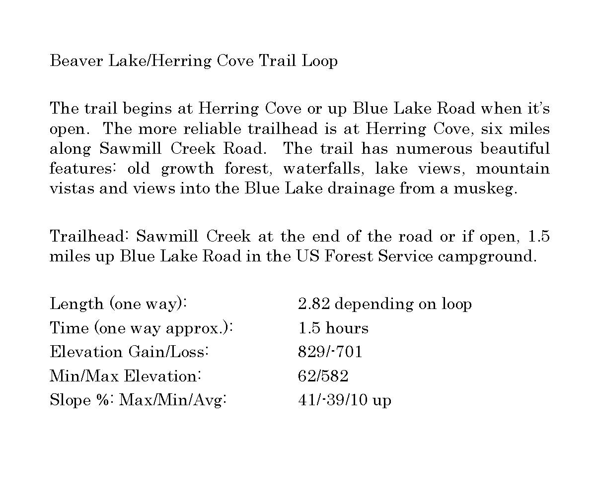
- DISTANCE : Multiple trail distances available up to 2.9 miles (one-way)
- 2.9 miles (one-way) from Herring Cove to Sawmill Creek Campground along north side of Beaver Lake
- 2.8 miles (loop) from Sawmill Creek Campground around Beaver Lake and back
- 3.6 miles (loop) from Herring Cove around Beaver Lake and back
- 3.45 miles (one-way) from Herring Cove to Sawmill Creek Campground via SMC and Blue Lake Roads
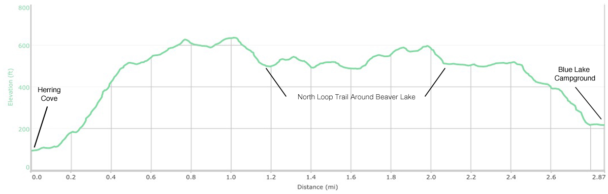
- TIME : 1.5 hours (one-way)
- ELEVATION GAIN : 520 feet
- RECOMMENDED SEASON : Early spring through late fall
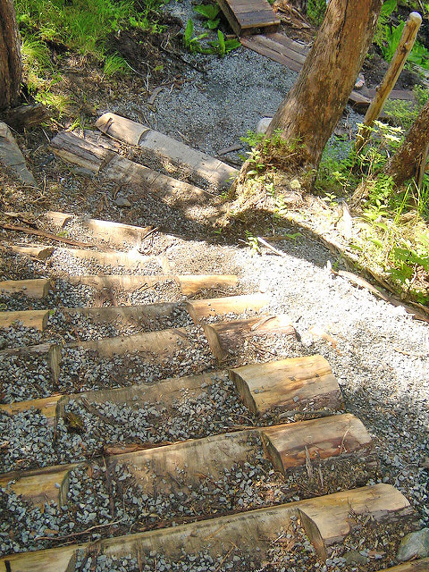
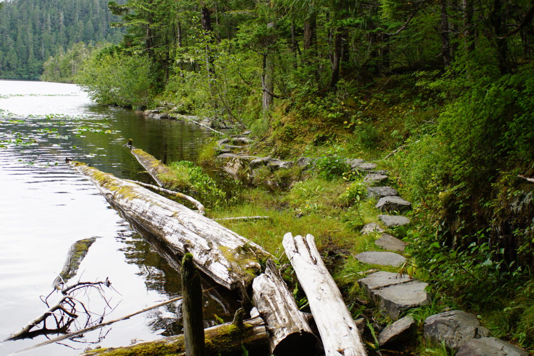
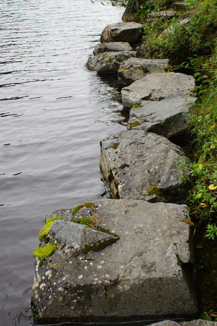
- LEVEL OF DIFFICULTY : Moderate. New alignment and recent rock/gravel work have the tread in great condition. Steep grade at the beginning/end of the trail. The middle section around the lakes is mostly level with some stepping stones and log steps.
- TRAIL MANAGEMENT AGENCIES : US Forest Service – Sawmill Creek Campground, around Beaver Lake and Herring Cove trail beyond the water fall viewing. City and Borough of Sitka – Herring Cove parking lot to large waterfall.
ACCESS
Primary access is from the Herring Cove Trailhead parking area at the end of Sawmill Creek Road 6 miles east of Sitka. Drive past Gary Paxton Industrial Park and Blue Lake Road. Beyond the Sawmill Creek Bridge the road is gravel for another mile, beware of potholes! Take an immediate left after driving through the gate to reach the Herring Cove parking lot.
Access from Blue Lake Road is about 5 miles east of Sitka. At mile 5.5 on Sawmill Creek Road across from the pulp mill, turn left onto the uphill gravel road. Go 1.5 miles along Blue Lake Road to the Sawmill Creek Campground, first right. The trail begins across the bridge over Sawmill Creek on the south side of the open gravel area.
SPECIAL FEATURES
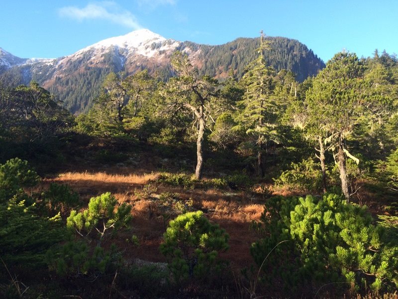
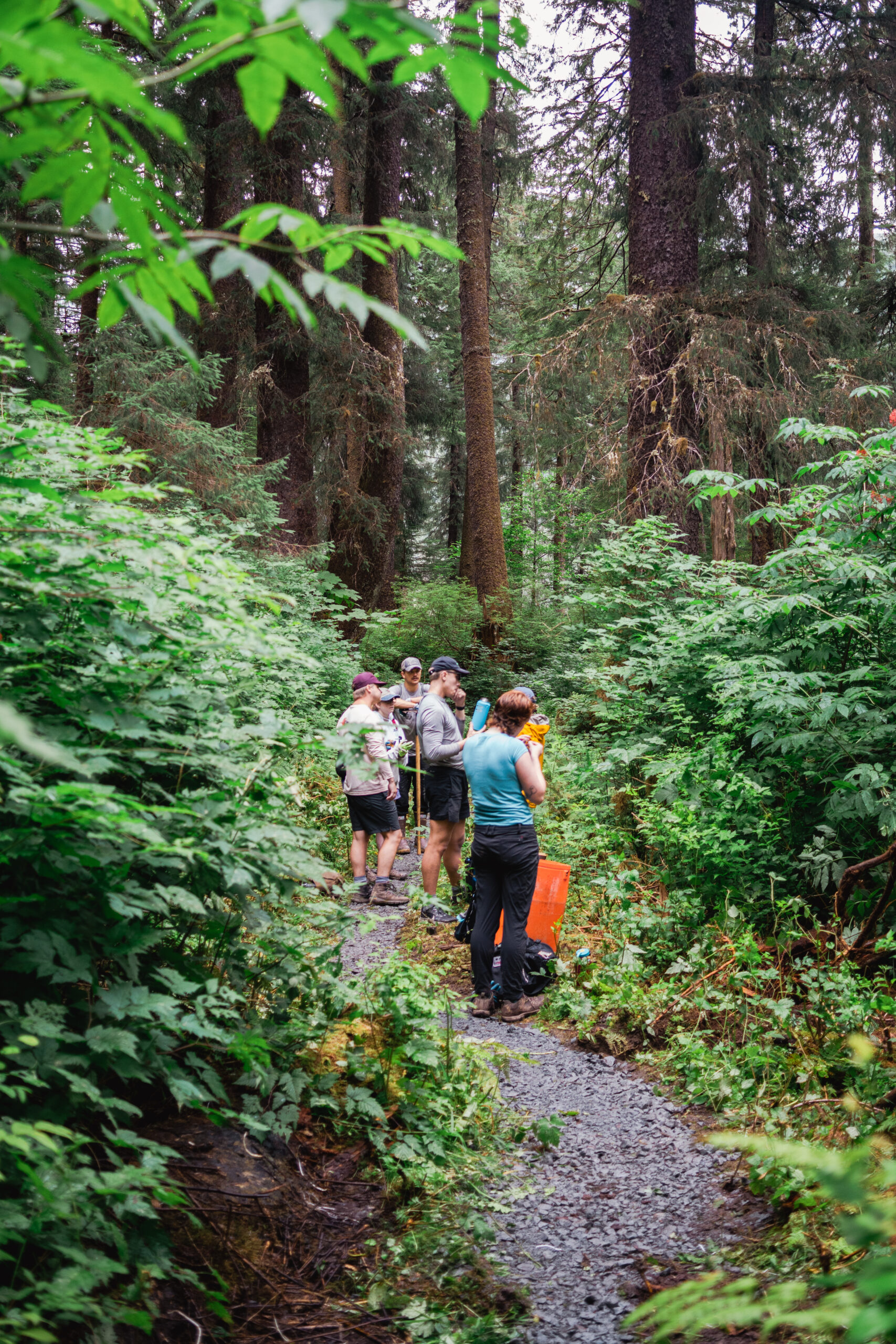
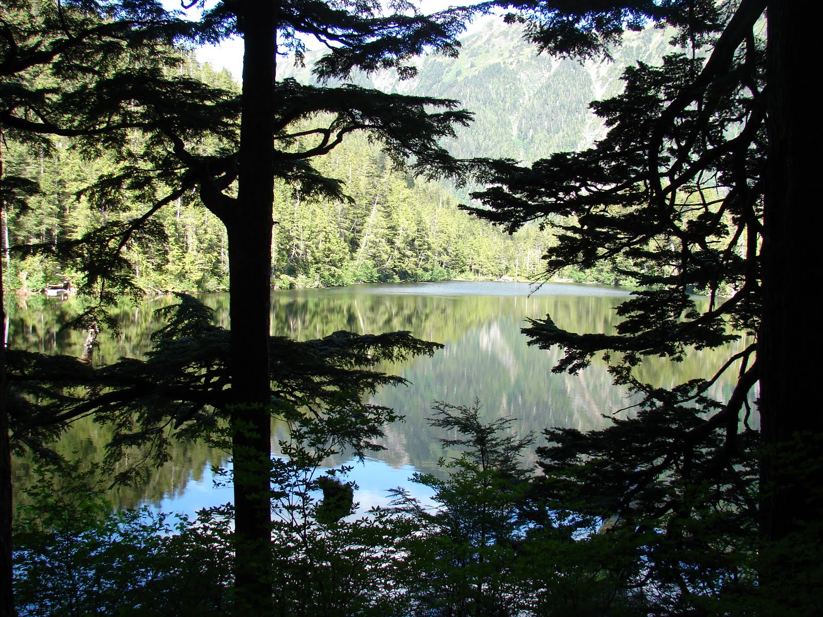
One of Sitka’s favorite hiking trails. By Beaver Lake there are great vistas of nearby rugged mountains. Lovely walk over muskegs, along marshes and through stunted forests. Beaver Lake has been stocked periodically with grayling between 1986 and 1991. The Forest service has installed new docks and picnic pads at the lake. An aluminum rowboat is available for use by the public at one of them. Please leave the oars in the boat, tie it up, and bail it out completely. At the back side of the lake tremendous, old growth trees are found.
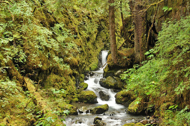
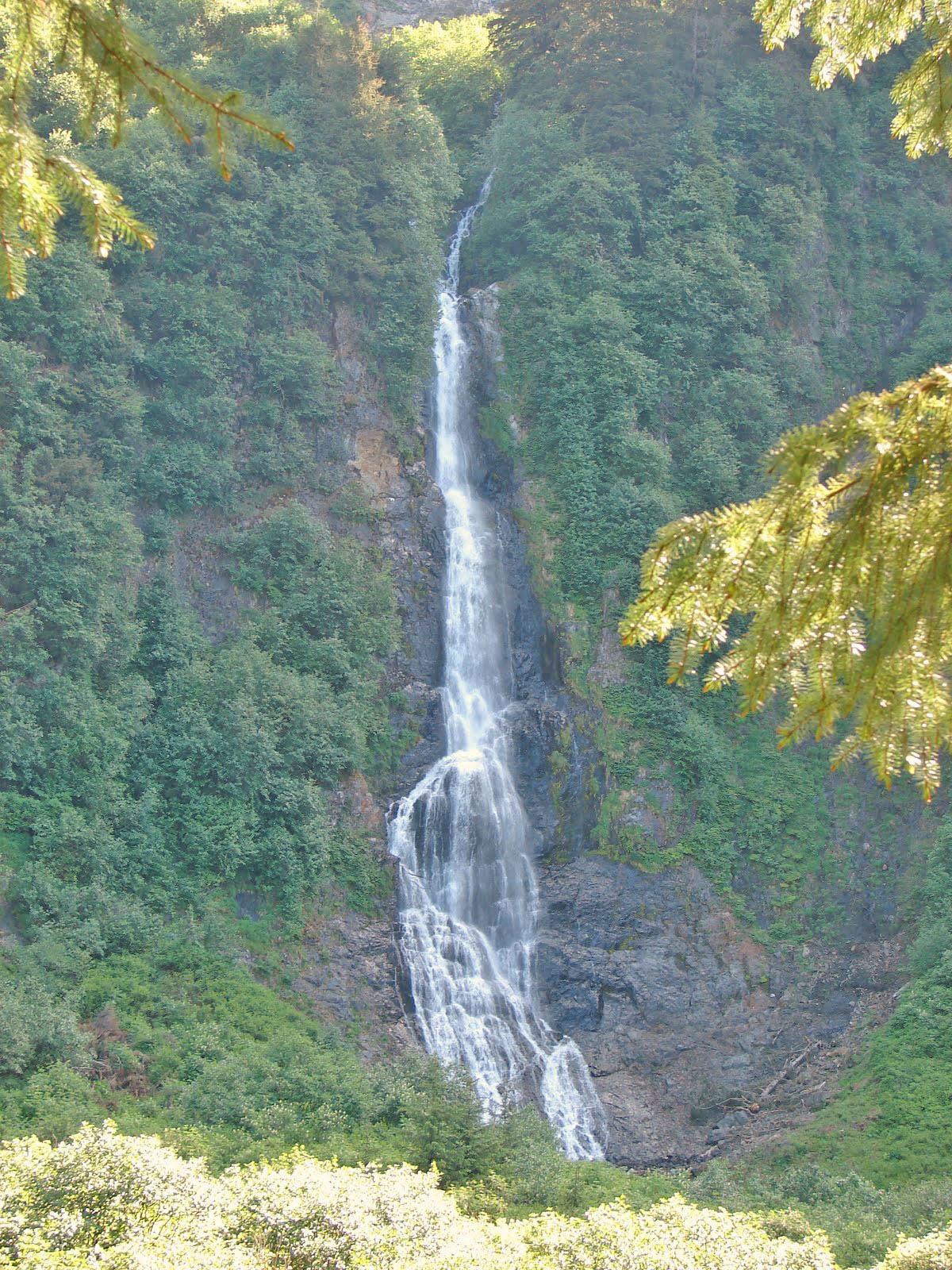
The Herring Cove trail parallels a stream with a series of waterfalls. After one climbs the first steep hillside, the trail flattens out in a glacially formed “hanging valley” with large old growth trees. A 100’+ waterfall is at the top of the valley. Beyond the waterfall the trail goes across boardwalk, up a hill and then back down to Beaver Lake.
DESCRIPTION
From Herring Cove Trailhead – This trail is a cooperative project by Sitka Trail Works, the Rasmuson Foundation, the USFS and CBS. The trail begins with short accessible pathway to the first bridge. The Trailhead parking area and ADA accessible trail was built by Sitka Trail Works. A scenic little waterfall marks the beginning of the narrower and less accessible trail, built by Oregon Woods contractors employing former Trail Works construction crew members. Designed by Barth Hamberg of the US Forest Service, it was built with gravel surfacing, rock armoring and minimizes the use of log steps for durability. The trail begins to climb and takes advantage of large boulders and trees for some whimsical trail features. A tight squeeze through a rock passageway makes a nice photo spot. After this cleft, the trail climbs rapidly on rock steps parallel to the rushing cascade. There are several observation spots along the trail for views of the freshet or to catch your breath. Eventually the trail levels out through a scenic gorge with views up the avalanche chute and waterfalls. After a more level section, the trail drops abruptly to join the Beaver Lake loop down artfully placed rock steps. Caution should be taken during heavy rain events due to potential flooding and be aware of an avalanche danger as well. Dogs should be leashed through all wetland areas to minimize damage to delicate vegetation and mosses along the trail.
From Blue Lake Road/Sawmill Creek Campground – The marked trailhead is on the south side of a small clearing in the alder just southwest of the bridge. The trail is steep for the first quarter mile with an elevation gain of about 200 feet spread over several switchbacks. The trail climbs through an open forest of hemlock, Sitka spruce and yellow cedar. The mostly gravel trail runs through open forest and parallels the Beaver Lake outlet stream and associated marshes and muskegs. The trail leads to several fishing platforms along the southern edge of the lake. The trail continues from this point around the circumference of the lake along the shores and through open forests back to the fishing platforms.
OTHER SOURCES:
http://www.fs.usda.gov/recarea/tongass/recreation/hiking/recarea/?recid=79060&actid=50
http://www.fs.usda.gov/recarea/tongass/recreation/hiking/recarea/?recid=79083&actid=50


Join the discussion One Comment