
- USE : Hike
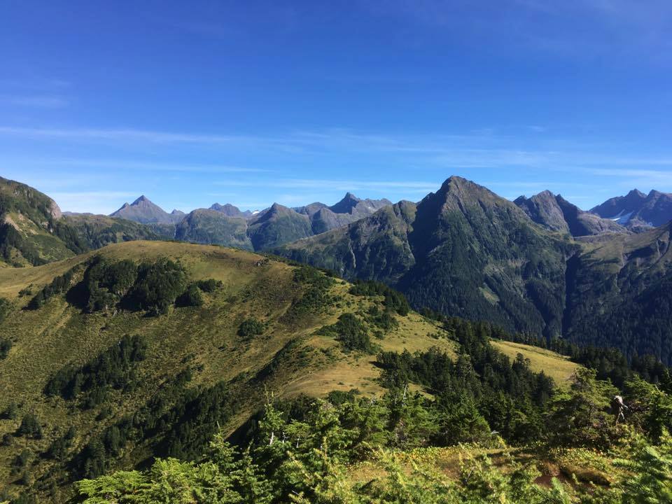
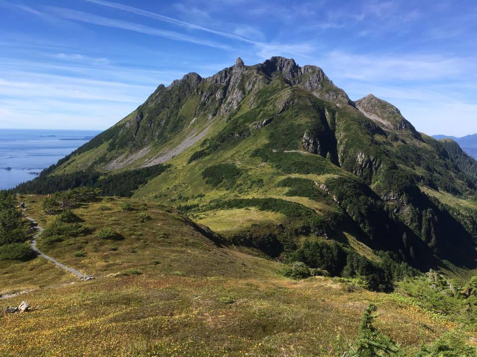
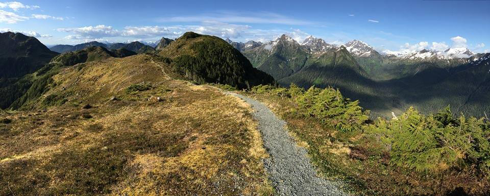
- DESCRIPTION : At the summit, excellent views of Sitka Sound, Baranof Island, Kruzof Island, Mt Edgecumbe and more peaks. Eagles and deer can be seen frequently along the trail when above tree line.
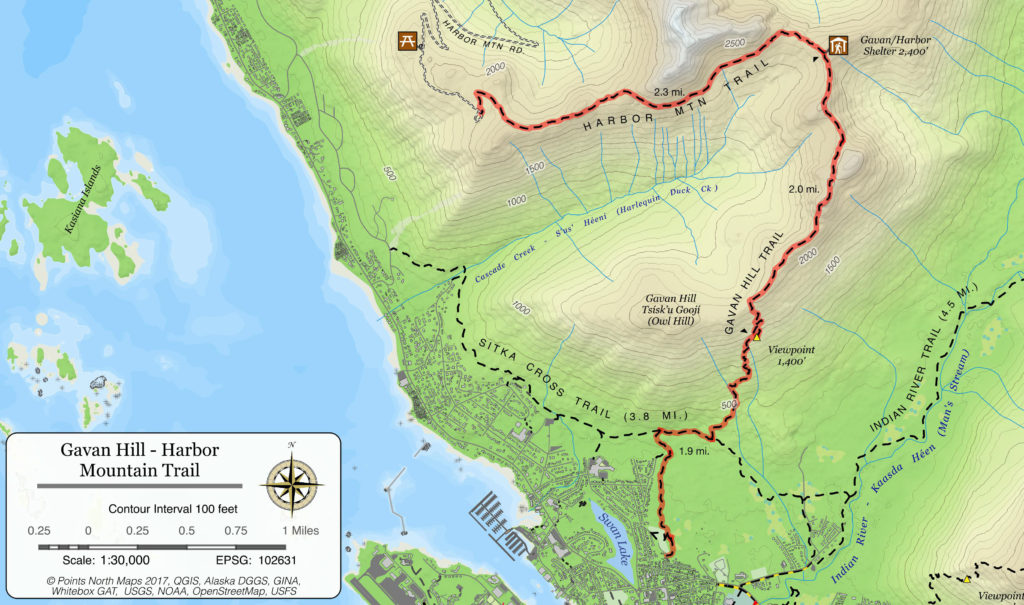
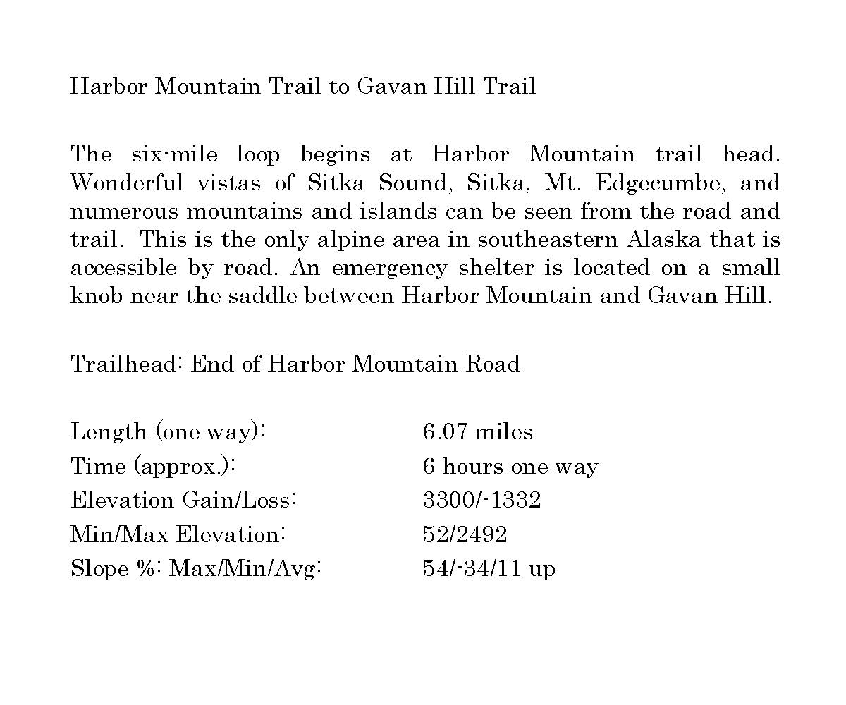
- DISTANCE : 6 miles (one-way)
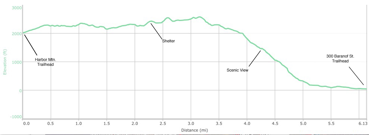
- 2.4 miles from Harbor Mountain parking lot to Harbor Mountain shelter, 1000′ elevation gain – ups and downs
- 1.5 miles from the shelter to Gavan Ridge, 600′ elevation loss
- 2.1 miles from the ridge to Baranof Street trailhead, 2400′ elevation loss
- TIME : 6 Hours (one-way)
- TRAILHEADS – End of Harbor Mountain Road & Baranof Street Trailhead. Also accessible via Cross Trail connectors at Sitka High School or Yaw Drive. To start at Harbor Mountain and end at Baranof Street trailhead, you will have to stage a car at either trailhead, loop back to the other trailhead, or trade keys (and cell phone numbers) with someone going the other way.
- RECOMMENDED SEASON : Mid-spring through fall (though there is good skiing and snowshoeing on the ridges in winter). Beware avalanche areas.
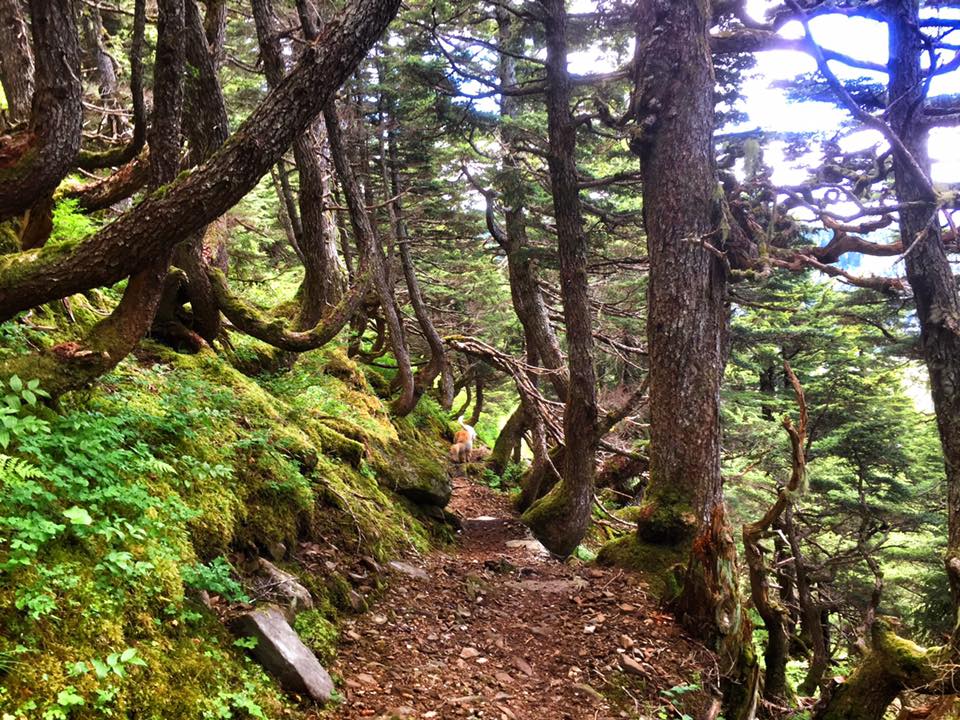
- LEVEL OF DIFFICULTY : Moderate to difficult. Steep climbs and some areas where footing is difficult. There are extensive stairs, steps, roots, rocks, and log steps. Boardwalk sections can be very slippery when wet or icy.
- TRAIL MANAGEMENT AGENCY : US Forest Service; Cross Trail portion by City and Borough of Sitka
ACCESS
Harbor Mountain Trailhead – Go approximately 4 miles northwest of Sitka along Halibut Point Road and turn right onto Harbor Mountain Road. The paved and gravel road winds 5 miles up Harbor Mountain gaining 2,000 feet in elevation. This is a steep climb with sharp switchbacks. RVs and vehicles pulling trailers should not attempt the drive.
The Forest Service closes the road in early winter to vehicles, and opens it with adequate snow cover for snow machines and ATVs. For restrictions and closures: see the USFS Harbor Mountain Road and Recreation Area page.
The large parking lot can fill up quickly on weekends and sunny days.
HISTORY
Harbor Mountain Road was built during World War II to provide access for building a lookout and other military installations at the top of the mountain (Fort Ray).
SPECIAL FEATURES
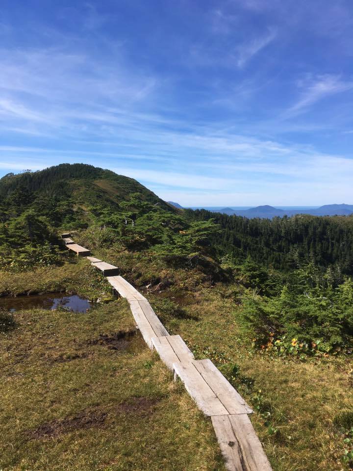
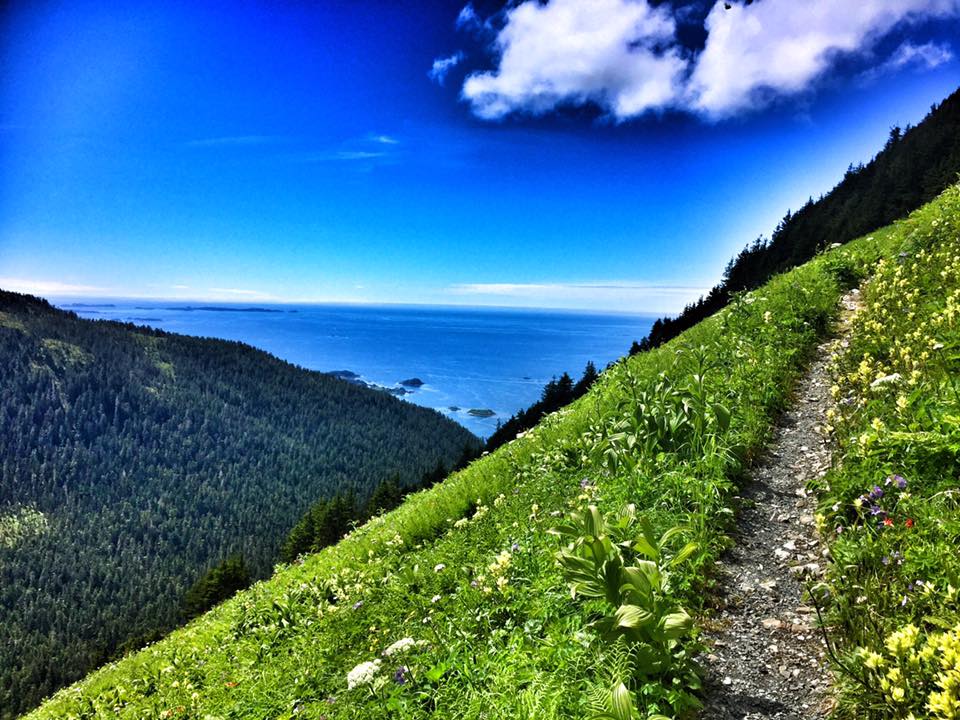
This is the only alpine area in southeastern Alaska that is accessible by road. Wonderful vistas of Sitka Sound, Sitka, Mt. Edgecumbe, and numerous mountains and islands can be seen from the road and trail. The Harbor Mountain Trail has recently received a major restoration and re-routing by the Forest Service. Many steep grades have been rerouted and the tread smoothed with gravel. They also designed several rock benches for picnic spots along the way. This trail connects with Gavan Hill Trail, which terminates in Sitka on Baranof Street.
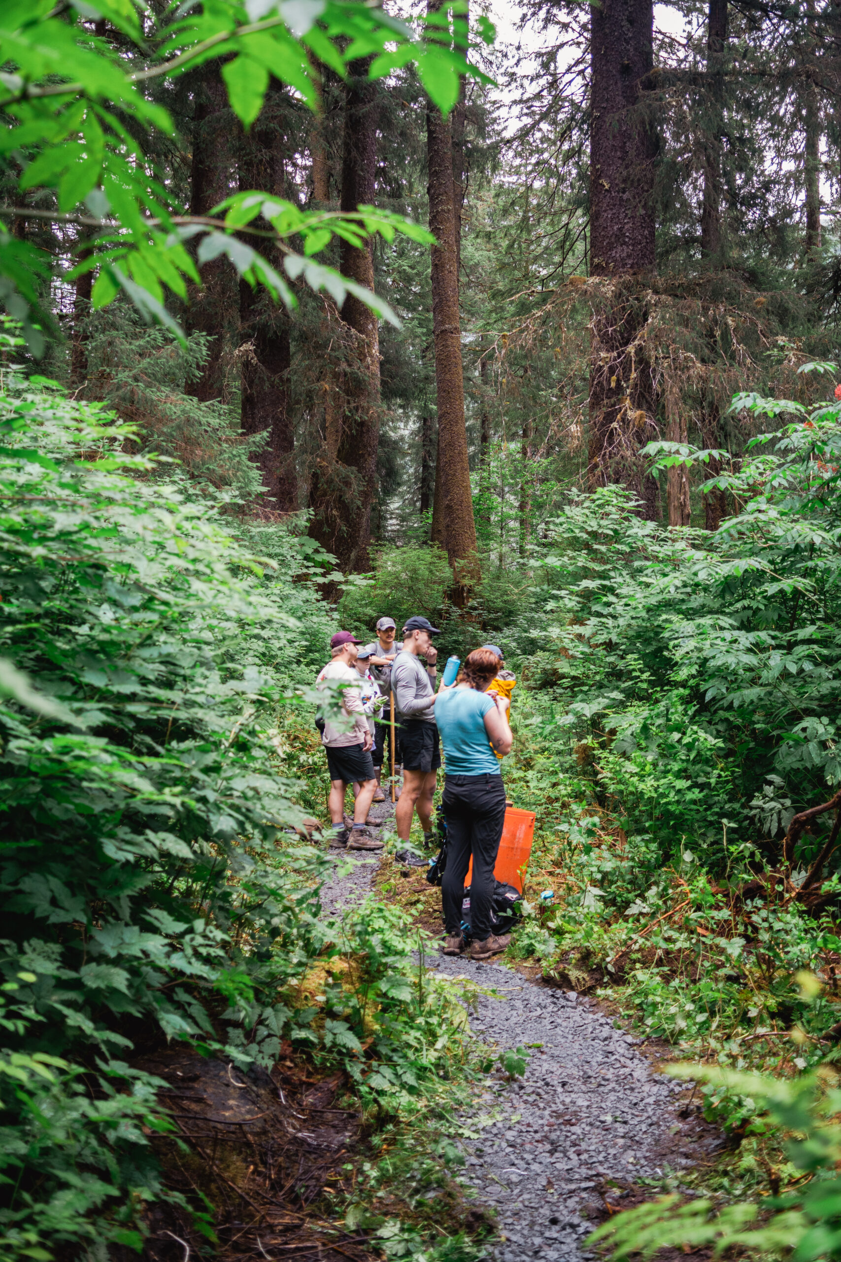
A shelter is located on a small knob near the saddle between Harbor Mountain and Gavan Hill. Access is available on a first-come, first-served basis. Campfires are discouraged in this sensitive sub-alpine environment.
Please don’t cut the trees – they are very few and slow growing. Be sure to leave no trace and pack it out.
Weather: The weather can deteriorate very quickly on the ridges and peaks. It may be sunny in the parking lots but very windy and wet up high. Be sure to dress appropriately and carry the 10 essentials (plus a few we added for Sitka) and be prepared for very bad weather and cold, wet conditions. Be a safe hiker and turn back if the weather deteriorates or visibility is compromised by clouds. Sitka Search and rescue has had to rescue many hikers along this route. Don’t be the next victim.
DESCRIPTION
The trail begins at the end of Harbor Mountain Road. The trailhead is marked by a bulletin board and handrails, and proceeds up the hillside in a series of switchbacks, gaining 300 feet in elevation. At the ridge, a short spur trail leads to the left to an overlook. The main trail turns to the right and follows the ridge toward the summit of a knob where WWII lookout (Fort Ray) ruins are located.
Before reaching the summit, however, the trail turns east and runs along the hillside of an immense north-facing sub-alpine meadow. The trail then follows along a ridge toward the peaks of Harbor Mountain. The view from this ridge is spectacular: mountains, deep valleys, alpine rock fields, high meadows, twisted trees and wildflowers.
As the trail continues on toward the rocky peaks of Harbor Mountain, it forks off to the right and skirts the hillside, circling around Gavan Ridge to Gavan Hill, then drops steeply down steps and stairs to town. The other fork of the trail continues up the steep shoulder slope of the peaks, and ends as it reaches the steep rocky alpine at about 2,500 feet.
OTHER SOURCES:
For information on the WWII radar site on Harbor Mountain see Harbor Defenses of Sitka. http://www.sitkaww2.com/harbordefenses/Locations/harbormtn/harbormtn.html
US Forest Service Harbor Mountain Rec. Area page:
http://www.fs.usda.gov/tongass/
http://www.fs.usda.gov/detail/tongass/about-forest/districts/?cid=stelprdb5397106
http://alaska.ustrails.org/trails/Harbor-Mountain-Gavan-Hill-Trail.html


")
Join the discussion 2 Comments