
- USE : Hike and Bike
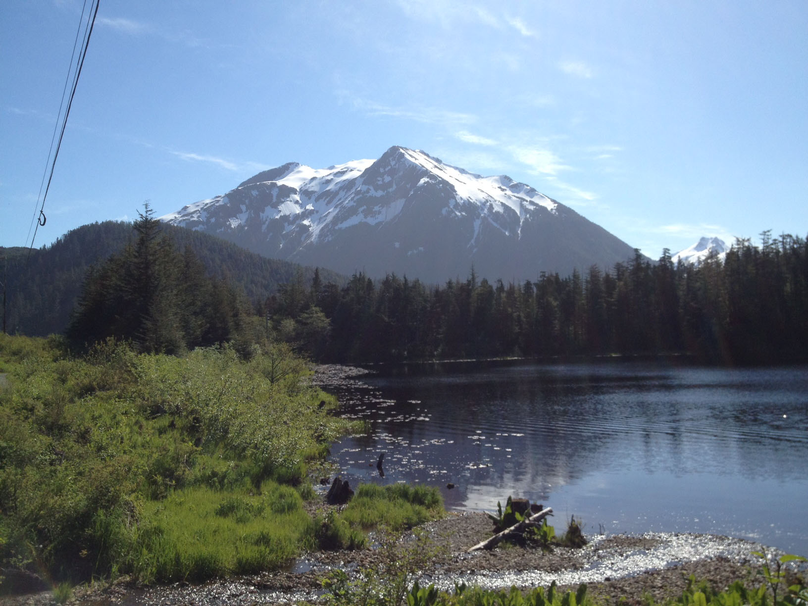
- DESCRIPTION : Nice views of Thimbleberry and Heart Lakes. Bears often frequent the area of the trail in particular when berries are ripe.
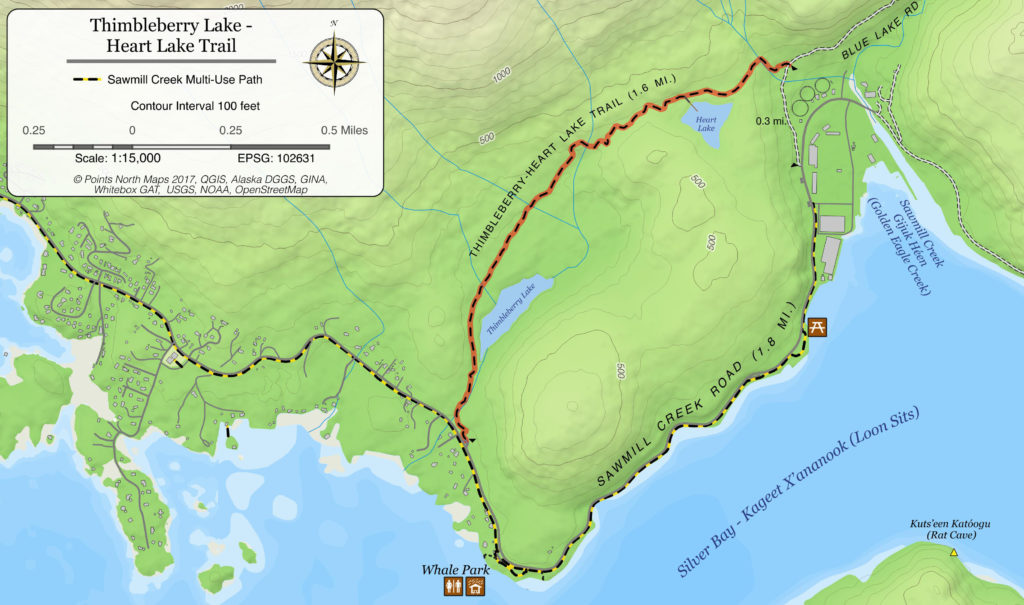
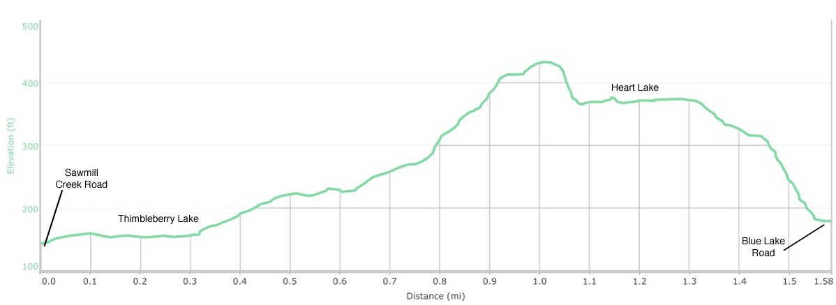
- DISTANCE : 0.25 mile to Thimbleberry Lake, 1 mile to Heart Lake (one way). 1.6 mile to Blue Lake Road Trailhead.
- TIME : 1 hour (one way) hiking, 30 min biking. Two hours to do loop back along Sawmill Creek Road separated path.
- TWO TRAILHEADS :
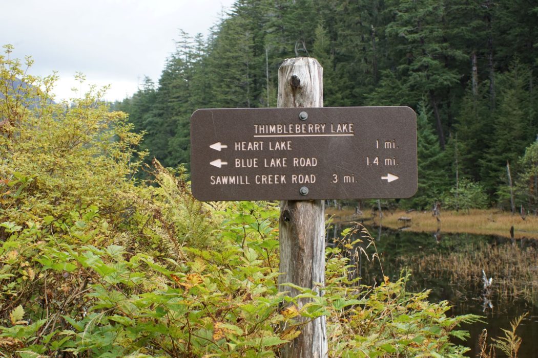
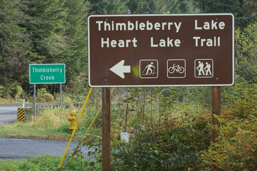
- Thimbleberry Lake Trailhead begins four miles southeast of Sitka on Sawmill Creek Road just past Thimbleberry Creek.
- Heart Lake Trailhead is 0.3 mile up Blue Lake Road, which is typically open to vehicle traffic April-November. Call the City and Borough of Sitka at (907) 747-1800 for road updates. If the gate is closed, park across from Gary Paxton Industrial Park and hike up the road to the trailhead.
- ELEVATION GAIN : 100 feet to Thimbleberry Lake, 350 feet to Heart Lake
- RECOMMENDED SEASON : Year round
- LEVEL OF DIFFICULTY : Easy to moderate. Trail has been recently re-finished and is a bit less steep from the south trailhead, though both offer a nice reward after a short climb. Bears may be present.
- TRAIL MANAGEMENT AGENCY : City and Borough of Sitka

ACCESS
TWO TRAILHEADS:
Thimbleberry Trailhead: The trail begins about 4 miles southeast of Sitka on Sawmill Creek Road. Cross Thimbleberry Creek Bridge (watch for sign) and immediately to your left is a trailhead sign and parking area.
A separated bike path and bike lanes will get you from downtown to the Thimbleberry trailhead.
Heart Lake Trailhead: Access from Blue Lake Road is about 5 miles east of Sitka. At mile 5.5 on Sawmill Creek Road across from the pulp mill, turn left onto the uphill gravel road. Blue Lake Road is closed in the winter and may be closed during project or road work.
Once at the Blue Lake Road trailhead, bicycles and hikers can continue up Blue Lake Road for more views and good riding. The next trail up the valley is the Beaver Lake Trail via Sawmill Creek Campground.
DESCRIPTION
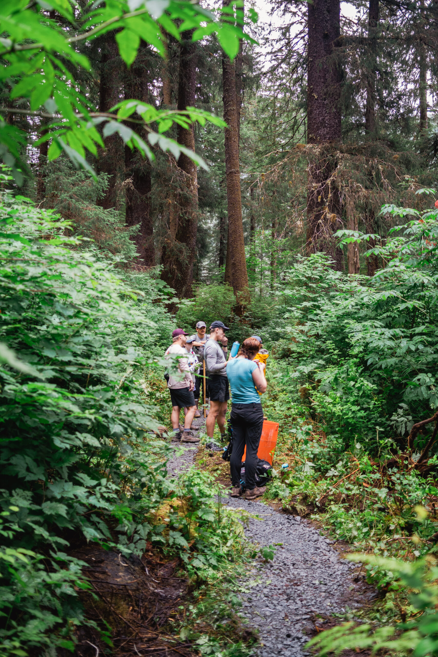
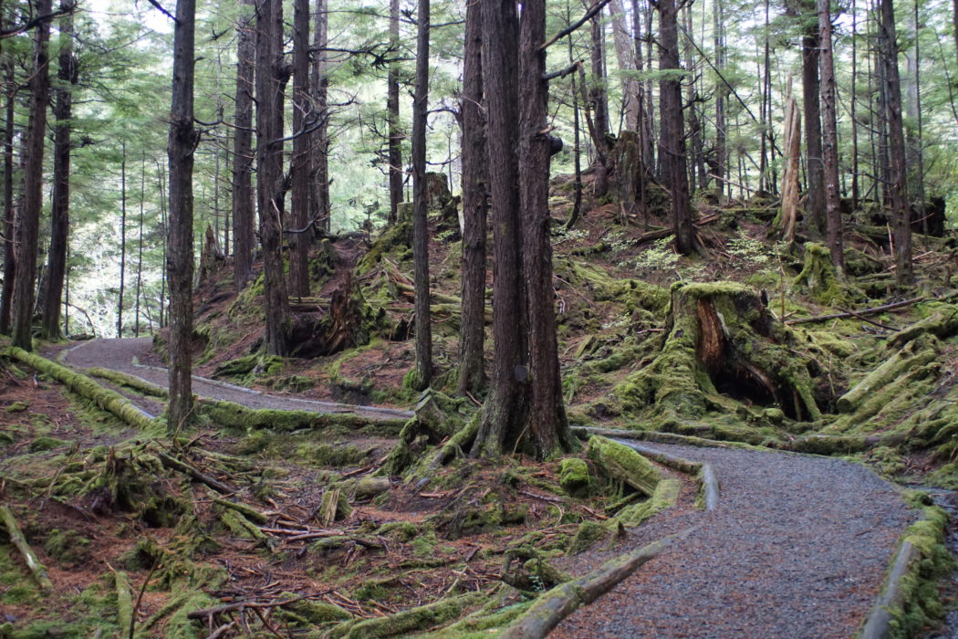
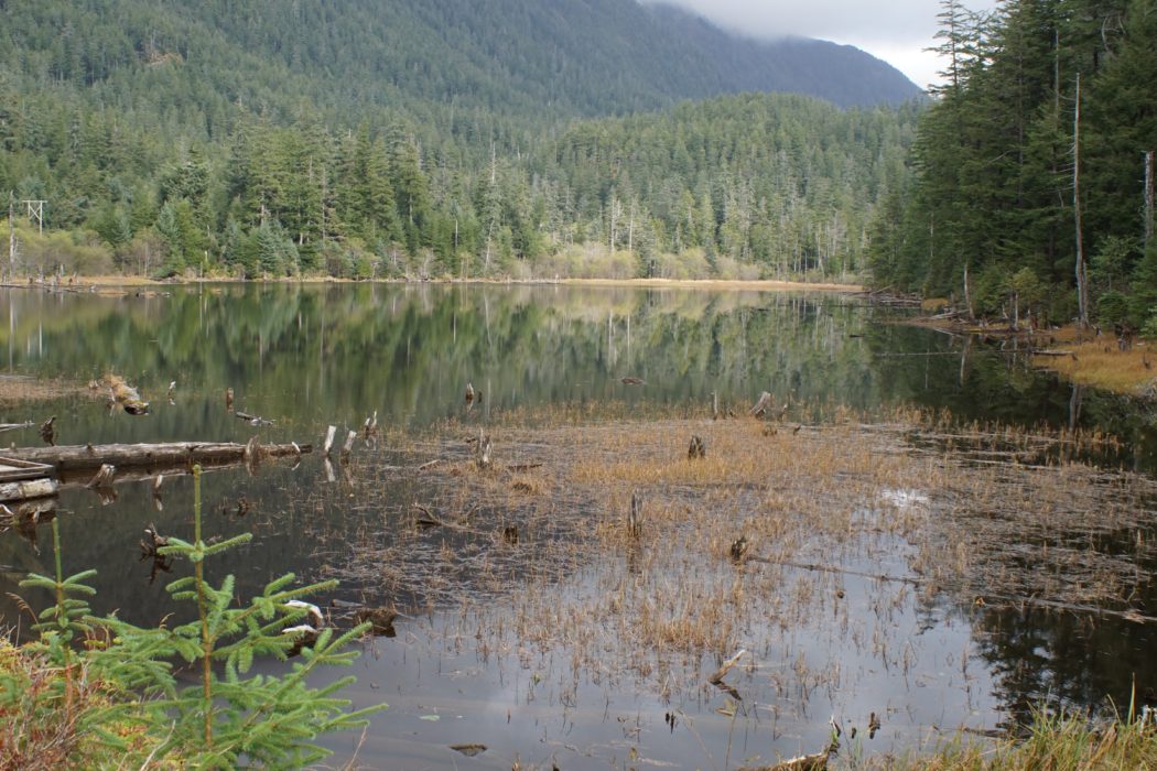
From Thimbleberry Lake Trailhead: The trail climbs rapidly through a hemlock-spruce forest for about an eighth of a mile, to the left below the bridge is Thimbleberry Falls. After a few switchbacks and bridges, the trail follows a powerline corridor to Thimbleberry Lake. The distance to the first lake is an easy 0.25 miles. A small dock and a skate changing area is at the lake outlet. In the winter it is a favorite skating spot, although it can be quite windy. The lakeshore is fairly accessible. Fishing for trout is fair, with the best spot being at the northeast end of the lake, near the inlet stream.
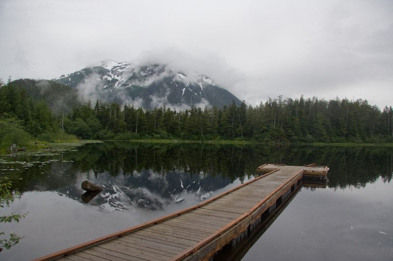
The trail continues along the north and east sides of the lake, following the powerline corridor. Follow the trail up and over a somewhat steep rise about a half mile further to Heart Lake, which features a small dock. Heart Lake is a local swimming hole in the summer and a great skating spot in the winter. The trail continues around the south end of Heart Lake, splashes across a small stream, and continues down a steep grade to Blue Lake Road.
OTHER SOURCES
US Forest Service trails site.
http://www.fs.usda.gov/recarea/tongass/recreation/hiking/recarea/?recid=79142&actid=50


