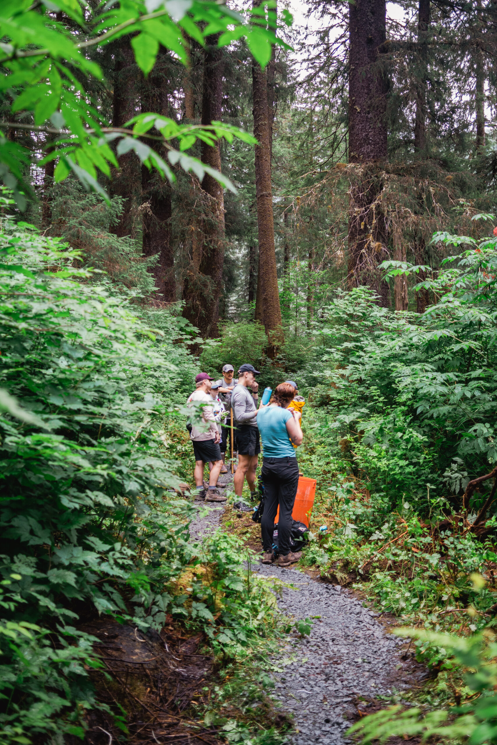
Loading 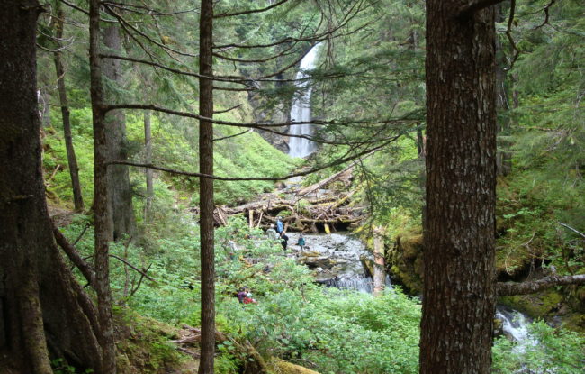  • USE : Hike • DESCRIPTION : Relaxing walk along Kaasda Héen (Indian River) through northwest coast rainforest with views of the Sisters Mountain, wildlife and more. The trail follows a salmon stream, so expect high levels of bear activity during spawning season. • DISTANCE : 4.38 miles (one way) • TIME : 2-3 hours (one way) • TRAILHEAD : Begins at parking lot 0.5 miles down Indian River Road on right. Ends near the base of Indian River falls. • ELEVATION GAIN : Approximately 1000 feet • RECOMMENDED SEASON : Year round • LEVEL OF DIFFICULTY : Easy. Climbs gradually. Easy to find, clear, in fair condition. Some muddy spots. The last few hundred feet to the base of the falls is not a trail; more like boulder-hopping through the creek. Bikes not currently allowed on trail past the pump house gate. • TRAIL MANAGEMENT AGENCY : US Forest Service [vc_row type="in_container" full_screen_row_position="middle" bg_color="#ffffff" scene_position="center" text_color="dark" text_align="left" overlay_strength="0.3"][vc_column column_padding="no-extra-padding" column_padding_position="all" background_color_opacity="1" background_hover_color_opacity="1" width="1/1" tablet_text_alignment="default" phone_text_alignment="default"][vc_row_inner text_align="left"][vc_column_inner column_padding="no-extra-padding" column_padding_position="all" background_color_opacity="1" width="1/3"][image_with_animation image_url="1114" alignment="" animation="Fade In" img_link_large="yes" box_shadow="none" max_width="100{abf465c19454c250f574557adc626a2e06d1cd01c0781f16298455748ce24614}"][/vc_column_inner][vc_column_inner column_padding="no-extra-padding" column_padding_position="all" background_color="#ffffff" background_color_opacity="1" centered_text="true" width="2/3"][image_with_animation image_url="1097" alignment="" animation="Fade In" img_link_large="yes" box_shadow="none" max_width="100{abf465c19454c250f574557adc626a2e06d1cd01c0781f16298455748ce24614}"][/vc_column_inner][/vc_row_inner][/vc_column][vc_column column_padding="no-extra-padding" column_padding_position="all" background_color_opacity="1" background_hover_color_opacity="1" width="1/1" tablet_text_alignment="default" phone_text_alignment="default"][/vc_column][/vc_row][vc_column column_padding="no-extra-padding" column_padding_position="all" background_color_opacity="1" background_hover_color_opacity="1" width="1/1" tablet_text_alignment="default" phone_text_alignment="default"][/vc_column][vc_gallery type="image_grid" images="682,683,684,1615,685,1614,1613,1612,398" layout="3" gallery_style="1"] 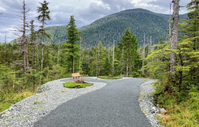 • USE : Bike and walk, cross country ski in winter. • DESCRIPTION : Wide and accessible new gravel trail connecting neighborhoods, parks, and schools. A new extension to Starrigavan opened in 2023. • DISTANCE : Up to 8 miles (one way) from Kaasda Héen (Indian River) to Starrigavan, including a little over a mile on roadway shoulder. • TIME : 1-2.5 hours (one way) • TRAILHEADS : Begins at the Indian River Trailhead 0.5 miles down Indian River Road near Yaw Dr. Yaw separated path runs 0.33 miles until it connects to the main Cross Trail. Cross Trail ends several miles later at Starrigavan Cove & the cruise ship terminal dock. Many access points are present along the trail. Multiple loops are possible to neighborhoods, ball fields, parks, and stores. See map below. • ELEVATION GAIN : 100-200 feet (mostly rolling hills) • RECOMMENDED SEASON : Year round • LEVEL OF DIFFICULTY : Mostly easy, with a few moderate sections. The trail is barrier free, but some grades approach 15% for short distances. The trail is bike-able throughout. • TRAIL MANAGEMENT AGENCY : City and Borough of Sitka [vc_row type="in_container" full_screen_row_position="middle" bg_color="#ffffff" scene_position="center" text_color="dark" text_align="left" overlay_strength="0.3"][vc_column column_padding="no-extra-padding" column_padding_position="all" background_color_opacity="1" background_hover_color_opacity="1" width="1/1" tablet_text_alignment="default" phone_text_alignment="default"][vc_row_inner text_align="left"][vc_column_inner column_padding="no-extra-padding" column_padding_position="all" background_color_opacity="1" width="1/3"][image_with_animation image_url="1116" alignment="" animation="Fade In" img_link_large="yes" box_shadow="none" max_width="100{abf465c19454c250f574557adc626a2e06d1cd01c0781f16298455748ce24614}"][/vc_column_inner][vc_column_inner column_padding="no-extra-padding" column_padding_position="all" background_color="#ffffff" background_color_opacity="1" centered_text="true" width="2/3"][image_with_animation image_url="1101" alignment="" animation="Fade In" img_link_large="yes" box_shadow="none" max_width="100{abf465c19454c250f574557adc626a2e06d1cd01c0781f16298455748ce24614}"][/vc_column_inner][/vc_row_inner][/vc_column][/vc_row] ACCESS This trail skirts the mountainous edge of Sitka’s neighborhoods and will eventually link the ferry terminal to Sawmill Cove. One can get to the Cross Trail in several locations around town beginning south to north: Indian River Trail, Baranof Street, Sitka High School, Kimsham Recreation Complex by Keet Gooshi Heen Elementary school, Cascade Creek, Kramer Ave, North Benchlands, Harbor Mountain Road, Cruise Ship Dock Connector/Starrigavan Cove. HISTORY Begun in 1998, Sitka’s Cross Trail was originally built by displaced loggers after Sawmill Cove sawmill shut down as a hiking trail. Since 2006 Sitka Trail Works has worked with the City and Borough of Sitka to convert the trail to a multimodal pathway with links to other trails and access to the local neighborhoods, visitor destinations, schools and the downtown core. SPECIAL FEATURES All failing boardwalk and slippery bridges have been replaced with a consistent 8 foot wide gravel tread that crosses streams with culverts instead of bridges where possible. The trail is mostly forested with a little open muskeg. Benches have been placed at regular intervals and scenic spots along the trail. It is the intention of the Trails Plan to complete this vital transportation link from end to end of the road system. Recent additions include a connector trail to Baranof Street and an extension to Kramer Drive. The trail corridor was cleared of trees specifically to allow adequate snow to fall on the trail for cross-country skiing and snowshoeing in winter, and to give bicyclists better visibility around corners. DESCRIPTION The trail traverses the toe-slope of the mountains along the edge of Sitka’s neighborhoods, and you will see few houses along the trail. Many different ecosystems may be seen along the route, muskeg, forested wetlands, old growth timber and second growth forest. A beautiful bridge crosses spectacular waterfalls at Cascade Creek. One can make a loop out of the many access points, and connect to climb Gavan Hill trail, or go downtown to watch a parade, jog from ball field to ball field, or just get from one side of town to the other. Be aware of bicycle traffic and dogs should remain on the trail to protect the fragile muskeg and wetlands. Cross Trail Signs_v3_DockConnectorKiosk 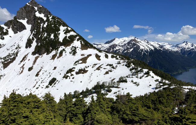 • USE : Hike • DESCRIPTION : A steep climb to spectacular views on a clear day. • LENGTH : 2.7 miles (one way) • TIME : 3 hours (one way) • TRAILHEAD : Begins 2 miles east of downtown on Sawmill Creek Road. Maintained trail ends at Picnic Rock. • ELEVATION GAIN : 2,550 feet to Picnic Rock • RECOMMENDED SEASON : Spring through late fall • LEVEL OF DIFFICULTY : Difficult. Steep trail with many switchbacks. Tread in places is poor and usually wet, slippery and muddy. Numerous log steps and rocky/rooty sections. Some ropes and cables to grab in some of the more exposed places. • TRAIL MANAGEMENT AGENCY : US Forest Service [vc_row type="in_container" full_screen_row_position="middle" bg_color="#ffffff" scene_position="center" text_color="dark" text_align="left" overlay_strength="0.3"][vc_column column_padding="no-extra-padding" column_padding_position="all" background_color_opacity="1" background_hover_color_opacity="1" width="1/1" tablet_text_alignment="default" phone_text_alignment="default"][vc_row_inner text_align="left"][vc_column_inner column_padding="no-extra-padding" column_padding_position="all" background_color_opacity="1" width="1/3"][image_with_animation image_url="1108" alignment="" animation="Fade In" img_link_large="yes" box_shadow="none" max_width="100{abf465c19454c250f574557adc626a2e06d1cd01c0781f16298455748ce24614}"][/vc_column_inner][vc_column_inner column_padding="no-extra-padding" column_padding_position="all" background_color="#ffffff" background_color_opacity="1" centered_text="true" width="2/3"][image_with_animation image_url="1092" alignment="" animation="Fade In" img_link_large="yes" box_shadow="none" max_width="100{abf465c19454c250f574557adc626a2e06d1cd01c0781f16298455748ce24614}"][/vc_column_inner][/vc_row_inner][/vc_column][/vc_row][vc_row type="in_container" full_screen_row_position="middle" scene_position="center" text_color="dark" text_align="left" overlay_strength="0.3"][vc_column column_padding="no-extra-padding" column_padding_position="all" background_color_opacity="1" background_hover_color_opacity="1" width="1/1" tablet_text_alignment="default" phone_text_alignment="default"][vc_column_text] ACCESS The small 2-car parking lot and trailhead sign are two miles east of downtown Sitka along Sawmill Creek Road. Walk, bike, or carpool to the trailhead if possible to avoid illegal parking. Look for the trailhead sign on the left, mountain-side shortly after Wolff Drive & Chirikov Drive. If you pass Jamestown Drive headed outbound, you've gone too far. Beware of traffic coming around the blind corner when parking and pulling out. Please don’t let dogs loose at the parking lot for the sake of the neighbors. HISTORY The name "Verstovia" is derived from "verst," an old Russian measurement unit. A "verst" is roughly 1,000 meters, which is almost exactly the height of Verstovia's upper peak. The lower hill slope was logged by the Russians in 1860 and evidence of charcoal pits remains about a quarter mile up the trail. The trail up Verstovia was first built in the 1930’s during the Civilian Conservation Corps era. SPECIAL FEATURES The trail ends in sub-alpine meadows and high ridges. The view is spectacular. Watch for bald eagles catching thermals. The alpine bowl east of Picnic Rock is the most popular destination for non-motorized winter recreation. Locals carry skis, snowboards, and sleds up to Picnic Rock throughout the winter. In some years, snow remains through May and June. DESCRIPTION From the small parking lot on Sawmill Creek Road, the first short segment of trail runs through thickets of alder and salmonberry. Soon thereafter it enters the western hemlock-spruce forest where it remains until breaking over the ridge on the west shoulder of Verstovia. About a third of a mile along the trail, switchbacks begin up the southwest side of the mountain. There are a couple of nice viewpoints with benches in the forest openings along this part of the trail. At about 2,000 feet the trail reaches a ridge and climbs east. The vegetation change between the 2,000 foot level and summit is dramatic. One moves from an open forest dominated by mountain hemlock into brushy meadows, across snowfields in winter and spring, through grassy sub-alpine meadows and finally into rocky alpine area with stunted, twisted plants. The maintained trail ends at Picnic Rock. The route to the upper peak of Verstovia, locally known as Arrowhead, is not an established trail and the upper section is very rough and exposed. The last part of the climb ascends a steep scree gully with loose rocks; only for the sure-footed climber with backcountry mountaineering experience. Falls could be fatal - in 2022, one hiker barely survived after sliding down hundreds of feet off the route. OTHER SOURCES: Sitka Trail Guide (Matt Goff) Sitka Trail Blog (Matt Goff) US Forest Service trail page [vc_row type="in_container" full_screen_row_position="middle" scene_position="center" text_color="dark" text_align="left" overlay_strength="0.3"][vc_column column_padding="no-extra-padding" column_padding_position="all" background_color_opacity="1" background_hover_color_opacity="1" width="1/1" tablet_text_alignment="default" phone_text_alignment="default"][vc_gallery type="image_grid" images="716,717,718,715,719,714,713,712,394,1491,1492" layout="3" gallery_style="1"][/vc_column][/vc_row]  • USE : Hike • DESCRIPTION : Begins near the end of Baranof Street at the Cross Trail/Gavan Trail trailhead, downtown. From Baranof Street follow the Cross Trail connector 0.8 miles to the Cross Trail, turn right and go 0.3 miles to reach the upper Gavan Hill Trail. It is well marked with signs. The upper Gavan Hill Trail has multiple staircases, switchbacks, and log steps with a steep climb. There are great views of the surrounding area. Continue along the ridge to the Harbor-Gavan Hill Shelter, and further to the Harbor Mountain Trail parking lot. • DISTANCE : 6 miles (one-way) • 2.1 miles from Baranof Street trailhead to ridge, 2400′ elevation gain • 1.5 miles from Gavan ridge to Harbor Mountain shelter, 600′ elevation gain • 2.4 miles from shelter to Harbor Mountain Trailhead, 1000′ elevation loss– ups and downs • TIME : 6 hours (one-way) • TRAILHEADS : Baranof Street trailhead & end of Harbor Mountain Road. Also accessible via Cross Trail connectors at Sitka High School or Yaw Drive. To start at Baranof Street and end at Harbor Mountain, you will have to stage a car at either trailhead, loop back to the Baranof Street trailhead, or trade keys (and cell phone numbers) with someone going the other way. • RECOMMENDED SEASON : Mid-spring through fall (though there is good skiing and snowshoeing on the ridges in winter). Beware avalanche areas. • LEVEL OF DIFFICULTY : Moderate to difficult. Steep climbs with some areas where footing is difficult. There are extensive stairs, steps, roots, rocks, and log steps. Boardwalk sections can be very slippery when wet or icy. • TRAIL MANAGEMENT AGENCY : US Forest Service; Cross Trail portion by City and Borough of Sitka [vc_row type="in_container" full_screen_row_position="middle" bg_color="#ffffff" scene_position="center" text_color="dark" text_align="left" overlay_strength="0.3"][vc_column column_padding="no-extra-padding" column_padding_position="all" background_color_opacity="1" background_hover_color_opacity="1" width="1/1" tablet_text_alignment="default" phone_text_alignment="default"][vc_row_inner text_align="left"][vc_column_inner column_padding="no-extra-padding" column_padding_position="all" background_color_opacity="1" width="1/3"][image_with_animation image_url="1106" alignment="" animation="Fade In" img_link_large="yes" box_shadow="none" max_width="100{abf465c19454c250f574557adc626a2e06d1cd01c0781f16298455748ce24614}"][/vc_column_inner][vc_column_inner column_padding="no-extra-padding" column_padding_position="all" background_color="#ffffff" background_color_opacity="1" centered_text="true" width="2/3"][image_with_animation image_url="1099" alignment="" animation="Fade In" img_link_large="yes" box_shadow="none" max_width="100{abf465c19454c250f574557adc626a2e06d1cd01c0781f16298455748ce24614}"][/vc_column_inner][/vc_row_inner][/vc_column][/vc_row][vc_row type="in_container" full_screen_row_position="middle" scene_position="center" text_color="dark" text_align="left" overlay_strength="0.3"][vc_column column_padding="no-extra-padding" column_padding_position="all" background_color_opacity="1" background_hover_color_opacity="1" width="1/1" tablet_text_alignment="default" phone_text_alignment="default"][vc_column_text] ACCESS The trail begins at the end of Baranof Street about 1/2 mile from downtown Sitka. The trailhead is well marked. There are 3-4 parking spots. If ending at Harbor Mountain trailhead, you will need to descend the mountain via Harbor Mountain Road. The paved and gravel road winds 5 miles up Harbor Mountain, gaining 2,000 feet in elevation. This is a steep climb with sharp switchbacks. RVs and vehicles pulling trailers should not attempt the drive. The Forest Service closes the road in early winter to vehicles, and opens it with adequate snow cover for snow machines and ATVs. For restrictions and closures: see the USFS Harbor Mountain Road and Recreation Area page. HISTORY The Gavan Hill portion of the trail was constructed in 1937 to provide forest access for recreation and hunting. Much of the boardwalk was built in the late 1990s. SPECIAL FEATURES A shelter is located on a small knob near the saddle between Harbor Mountain and Gavan Hill. Access is available on a first-come, first-served basis. Campfires are discouraged in this sensitive sub-alpine environment. Please don’t cut the trees – they are very few and slow growing. Be sure to leave no trace and pack it out. Weather: The weather can deteriorate very quickly on the ridges and peaks. It may be sunny in the parking lots but very windy and wet up high. Be sure to dress appropriately and carry the 10 essentials (plus a few we added for Sitka) and be prepared for very bad weather and cold, wet conditions. Don’t be too proud to turn back if the weather dictates. Sitka Search and Rescue has had to rescue many hikers along this route. Don’t be the next victim. DESCRIPTION The trail begins at the Baranof Street trailhead and goes 0.8 mile to the intersection with the main Cross Trail. It starts with 600′ of accessible trail; turn left before the bench. Upon reaching the junction with Cross Trail turn right and go another .3 miles to the upper Gavan Trail. At this point it becomes a hiking trail climbing to 2200’ in about one mile. The trail is very steep with stairs and steps with numerous switchbacks to Gavan Ridge. Turning right at the ridge and hiking 2.0 miles will take you to the shelter cabin. Hiking an additional 2.3 miles beyond the shelter leads one to the Harbor Mountain parking lot. OTHER SOURCES: For information on the WWII radar site on Harbor Mountain see Harbor Defenses of Sitka. http://www.sitkaww2.com/harbordefenses/Locations/harbormtn/harbormtn.html US Forest Service Harbor Mountain Rec. Area page: http://www.fs.usda.gov/tongass/ http://www.fs.usda.gov/detail/tongass/about-forest/districts/?cid=stelprdb5397106 http://alaska.ustrails.org/trails/Harbor-Mountain-Gavan-Hill-Trail.html [/vc_column_text][/vc_column][/vc_row][vc_row type="in_container" full_screen_row_position="middle" scene_position="center" text_color="dark" text_align="left" overlay_strength="0.3"][vc_column column_padding="no-extra-padding" column_padding_position="all" background_color_opacity="1" background_hover_color_opacity="1" width="1/1" tablet_text_alignment="default" phone_text_alignment="default"][image_with_animation image_url="695" alignment="" animation="Fade In" img_link_large="yes" box_shadow="none" max_width="100{abf465c19454c250f574557adc626a2e06d1cd01c0781f16298455748ce24614}"][vc_gallery type="image_grid" images="707,1742,1743,706,1744,1425" layout="3" gallery_style="1"][/vc_column][/vc_row] 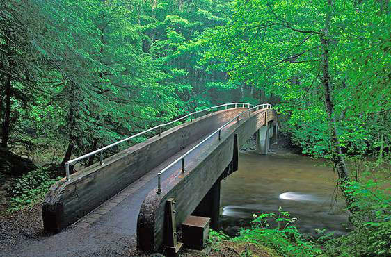 • USE : Walk (bikes must be walked) • DESCRIPTION : Scenic and accessible trail commemorates the site of the Battle of Sitka between the Kiks.ádi Clan (Tlingit) and the Russians in 1804. Historic and contemporary totem poles line the trails throughout the park. • DISTANCE : 1.5 miles (one way) • TIME : 1 hour (one way) • TRAILHEADS : Begins and ends at the Sitka National Historical Park Visitor Center • ELEVATION GAIN : 20 feet • RECOMMENDED SEASON : Year round • LEVEL OF DIFFICULTY : Easy. Well maintained, dry, level trail. • TRAIL MANAGEMENT AGENCY : US National Park Service ACCESS The accessible Sitka Sea Walk begins downtown at Harrigan Centennial Hall and leads to Sitka National Historical Park. The Sea Walk parallels Lincoln Street through Crescent Harbor Park, and leaves the roadway to meander through the forest after the Sitka Sound Science Center. Begin at the ocean front doors of the Visitor Center by the totem pole near the beach. HISTORY The park commemorates the site of the Battle of Sitka between the Kiks.ádi Clan (Tlingit) and the Russians in 1804. An informative brochure with a map can be obtained from the park's Visitor Center. DESCRIPTION Sitka National Historical Park trail is made to order for the stroller who wants a taste of southeast Alaska’s forests and waters in a non-strenuous setting. The well maintained trail is in Sitka spruce-western hemlock forest and parallels the shoreline of Eastern Channel. A guidebook is available at the Visitor Center that interprets the totem poles along the trail. During mid to late summer, red huckleberries and blueberries are common. Watch the shore and trees for ravens, eagles and other birds. Squirrels are likely to pop up year-round. There are numerous spur trails to the adjacent pebble and sand beach. At the southwestern end of the park there are a series of paths running through the beach meadows and grass flats. During the spring and early summer, these meadows support a wide array of colorful wildflowers. The main trail leads along Kaasda Héen (Indian River) where pink, chum, and coho salmon return to spawn during late summer and early fall. This is truly an amazing sight as thousands of fish are side by side flopping up the river. The best fish viewing point is the arched bridge. Cross over the bridge and follow another loop trail southeast along the river past the Russian Monument, or northwest through the forest back to the bridge. The Riverside Trail takes off right before the bridge on the Visitor Center side of the park and connects the park to Sawmill Creek Road. OTHER SOURCES: https://www.nps.gov/sitk/learn/index.htm [vc_row type="in_container" full_screen_row_position="middle" scene_position="center" text_color="dark" text_align="left" overlay_strength="0.3"][vc_column column_padding="no-extra-padding" column_padding_position="all" background_color_opacity="1" background_hover_color_opacity="1" width="1/1" tablet_text_alignment="default" phone_text_alignment="default"][image_with_animation image_url="667" alignment="" animation="Fade In" img_link_large="yes" box_shadow="none" max_width="100{abf465c19454c250f574557adc626a2e06d1cd01c0781f16298455748ce24614}"][divider line_type="No Line" custom_height="20"][vc_gallery type="image_grid" images="650,647,646,645,649,644,648" layout="4" gallery_style="1"][/vc_column][/vc_row]  USE : Hike DESCRIPTION : Popular trail well suited to family outings. Views of nearby rugged mountains, wildlife and muskeg. TWO TRAILHEADS : One at the steel bridge at Sawmill Creek Campground off Blue Lake Road and the other is the Herring Cove Trailhead. Blue Lake Road is typically open to vehicle traffic April-November. Call the City and Borough of Sitka at (907) 747-1800 for road updates. DISTANCE : Multiple trail distances available up to 2.9 miles (one-way) 2.9 miles (one-way) from Herring Cove to Sawmill Creek Campground along north side of Beaver Lake 2.8 miles (loop) from Sawmill Creek Campground around Beaver Lake and back 3.6 miles (loop) from Herring Cove around Beaver Lake and back 3.45 miles (one-way) from Herring Cove to Sawmill Creek Campground via SMC and Blue Lake Roads TIME : 1.5 hours (one-way) ELEVATION GAIN : 520 feet RECOMMENDED SEASON : Early spring through late fall LEVEL OF DIFFICULTY : Moderate. New alignment and recent rock/gravel work have the tread in great condition. Steep grade at the beginning/end of the trail. The middle section around the lakes is mostly level with some stepping stones and log steps. TRAIL MANAGEMENT AGENCIES : US Forest Service – Sawmill Creek Campground, around Beaver Lake and Herring Cove trail beyond the water fall viewing. City and Borough of Sitka – Herring Cove parking lot to large waterfall. [vc_row type="in_container" full_screen_row_position="middle" bg_color="#ffffff" scene_position="center" text_color="dark" text_align="left" overlay_strength="0.3"][vc_column column_padding="no-extra-padding" column_padding_position="all" background_color_opacity="1" background_hover_color_opacity="1" width="1/1" tablet_text_alignment="default" phone_text_alignment="default"][vc_row_inner text_align="left"][vc_column_inner column_padding="no-extra-padding" column_padding_position="all" background_color_opacity="1" width="1/3"][image_with_animation image_url="1104" alignment="" animation="Fade In" img_link_large="yes" box_shadow="none" max_width="100{abf465c19454c250f574557adc626a2e06d1cd01c0781f16298455748ce24614}"][/vc_column_inner][vc_column_inner column_padding="no-extra-padding" column_padding_position="all" background_color="#ffffff" background_color_opacity="1" centered_text="true" width="2/3"][image_with_animation image_url="1102" alignment="" animation="Fade In" img_link_large="yes" box_shadow="none" max_width="100{abf465c19454c250f574557adc626a2e06d1cd01c0781f16298455748ce24614}"][/vc_column_inner][/vc_row_inner][/vc_column][/vc_row] ACCESS Primary access is from the Herring Cove Trailhead parking area at the end of Sawmill Creek Road 6 miles east of Sitka. Drive past Gary Paxton Industrial Park and Blue Lake Road. Beyond the Sawmill Creek Bridge the road is gravel for another mile, beware of potholes! Take an immediate left after driving through the gate to reach the Herring Cove parking lot. Access from Blue Lake Road is about 5 miles east of Sitka. At mile 5.5 on Sawmill Creek Road across from the pulp mill, turn left onto the uphill gravel road. Go 1.5 miles along Blue Lake Road to the Sawmill Creek Campground, first right. The trail begins across the bridge over Sawmill Creek on the south side of the open gravel area. SPECIAL FEATURES One of Sitka’s favorite hiking trails. By Beaver Lake there are great vistas of nearby rugged mountains. Lovely walk over muskegs, along marshes and through stunted forests. Beaver Lake has been stocked periodically with grayling between 1986 and 1991. The Forest service has installed new docks and picnic pads at the lake. An aluminum rowboat is available for use by the public at one of them. Please leave the oars in the boat, tie it up, and bail it out completely. At the back side of the lake tremendous, old growth trees are found. The Herring Cove trail parallels a stream with a series of waterfalls. After one climbs the first steep hillside, the trail flattens out in a glacially formed “hanging valley” with large old growth trees. A 100’+ waterfall is at the top of the valley. Beyond the waterfall the trail goes across boardwalk, up a hill and then back down to Beaver Lake. DESCRIPTION From Herring Cove Trailhead – This trail is a cooperative project by Sitka Trail Works, the Rasmuson Foundation, the USFS and CBS. The trail begins with short accessible pathway to the first bridge. The Trailhead parking area and ADA accessible trail was built by Sitka Trail Works. A scenic little waterfall marks the beginning of the narrower and less accessible trail, built by Oregon Woods contractors employing former Trail Works construction crew members. Designed by Barth Hamberg of the US Forest Service, it was built with gravel surfacing, rock armoring and minimizes the use of log steps for durability. The trail begins to climb and takes advantage of large boulders and trees for some whimsical trail features. A tight squeeze through a rock passageway makes a nice photo spot. After this cleft, the trail climbs rapidly on rock steps parallel to the rushing cascade. There are several observation spots along the trail for views of the freshet or to catch your breath. Eventually the trail levels out through a scenic gorge with views up the avalanche chute and waterfalls. After a more level section, the trail drops abruptly to join the Beaver Lake loop down artfully placed rock steps. Caution should be taken during heavy rain events due to potential flooding and be aware of an avalanche danger as well. Dogs should be leashed through all wetland areas to minimize damage to delicate vegetation and mosses along the trail. From Blue Lake Road/Sawmill Creek Campground – The marked trailhead is on the south side of a small clearing in the alder just southwest of the bridge. The trail is steep for the first quarter mile with an elevation gain of about 200 feet spread over several switchbacks. The trail climbs through an open forest of hemlock, Sitka spruce and yellow cedar. The mostly gravel trail runs through open forest and parallels the Beaver Lake outlet stream and associated marshes and muskegs. The trail leads to several fishing platforms along the southern edge of the lake. The trail continues from this point around the circumference of the lake along the shores and through open forests back to the fishing platforms. OTHER SOURCES: http://www.fs.usda.gov/recarea/tongass/recreation/hiking/recarea/?recid=79060&actid=50 http://www.fs.usda.gov/recarea/tongass/recreation/hiking/recarea/?recid=79083&actid=50 [vc_row type="in_container" full_screen_row_position="middle" scene_position="center" text_color="dark" text_align="left" overlay_strength="0.3"][vc_column column_padding="no-extra-padding" column_padding_position="all" background_color_opacity="1" background_hover_color_opacity="1" width="1/1" tablet_text_alignment="default" phone_text_alignment="default"][vc_gallery type="image_grid" images="575,574,573,572,571,570,569,568,1465,1466" layout="4" gallery_style="1"][/vc_column][/vc_row]  • USE : Walk • DESCRIPTION : Oceanfront park with 3 picnic shelters and easy beach access. No restroom facilities or trash cans. Pack in, pack out all refuse. • DISTANCE : 0.5 mile (one way) • TIME : 30 minutes (one way) • TRAILHEAD : Loop trail begins at Granite Creek foot bridge near the center of the park. • ELEVATION GAIN : 30 feet • RECOMMENDED SEASON : Year round • LEVEL OF DIFFICULTY : Easy • TRAIL MANAGEMENT AGENCY : Alaska State Parks ACCESS The trail begins at the footbridge that crosses the Granite Creek within the Halibut Point State Recreation Site. This park is located approximately 4.5 miles north of Sitka on Halibut Point Road. Park at the second parking area and walk down the service road to the footbridge. SPECIAL FEATURES Three picnic shelters are located throughout the park. Picnic shelters can be reserved through Reserve America. This is a beautiful area to enjoy both mature Sitka spruce-western hemlock forests and scenic beaches. DESCRIPTION This is a loop trail with spur trails to the beach and a picnic shelter. After crossing the bridge, the trail goes either left or right. To the right are the spur trails to the beach. The main trail winds around through mature forests until coming out on the beach. The trail then follows the beach for a stretch, with views (and low tide access) of Magic Island, then winds back into the forest and returns to the footbridge. OTHER SOURCES: http://www.sitkatrails.org/trail-log/category/halibut-point-rec/ [vc_row type="in_container" full_screen_row_position="middle" scene_position="center" text_color="dark" text_align="left" overlay_strength="0.3"][vc_column column_padding="no-extra-padding" column_padding_position="all" background_color_opacity="1" background_hover_color_opacity="1" width="1/1" tablet_text_alignment="default" phone_text_alignment="default"][vc_gallery type="image_grid" images="811,812,813,487,814,488" layout="3" gallery_style="1"][/vc_column][/vc_row]  USE : Hike DESCRIPTION : At the summit, excellent views of Sitka Sound, Baranof Island, Kruzof Island, Mt Edgecumbe and more peaks. Eagles and deer can be seen frequently along the trail when above tree line. DISTANCE : 6 miles (one-way) 2.4 miles from Harbor Mountain parking lot to Harbor Mountain shelter, 1000′ elevation gain – ups and downs 1.5 miles from the shelter to Gavan Ridge, 600′ elevation loss 2.1 miles from the ridge to Baranof Street trailhead, 2400′ elevation loss TIME : 6 Hours (one-way) TRAILHEADS – End of Harbor Mountain Road & Baranof Street Trailhead. Also accessible via Cross Trail connectors at Sitka High School or Yaw Drive. To start at Harbor Mountain and end at Baranof Street trailhead, you will have to stage a car at either trailhead, loop back to the other trailhead, or trade keys (and cell phone numbers) with someone going the other way. RECOMMENDED SEASON : Mid-spring through fall (though there is good skiing and snowshoeing on the ridges in winter). Beware avalanche areas. LEVEL OF DIFFICULTY : Moderate to difficult. Steep climbs and some areas where footing is difficult. There are extensive stairs, steps, roots, rocks, and log steps. Boardwalk sections can be very slippery when wet or icy. TRAIL MANAGEMENT AGENCY : US Forest Service; Cross Trail portion by City and Borough of Sitka [vc_row type="in_container" full_screen_row_position="middle" bg_color="#ffffff" scene_position="center" text_color="dark" text_align="left" overlay_strength="0.3"][vc_column column_padding="no-extra-padding" column_padding_position="all" background_color_opacity="1" background_hover_color_opacity="1" width="1/1" tablet_text_alignment="default" phone_text_alignment="default"][vc_row_inner text_align="left"][vc_column_inner column_padding="no-extra-padding" column_padding_position="all" background_color_opacity="1" width="1/3"][image_with_animation image_url="1115" alignment="" animation="Fade In" img_link_large="yes" box_shadow="none" max_width="100{abf465c19454c250f574557adc626a2e06d1cd01c0781f16298455748ce24614}"][/vc_column_inner][vc_column_inner column_padding="no-extra-padding" column_padding_position="all" background_color="#ffffff" background_color_opacity="1" centered_text="true" width="2/3"][image_with_animation image_url="1098" alignment="" animation="Fade In" img_link_large="yes" box_shadow="none" max_width="100{abf465c19454c250f574557adc626a2e06d1cd01c0781f16298455748ce24614}"][/vc_column_inner][/vc_row_inner][/vc_column][/vc_row] ACCESS Harbor Mountain Trailhead – Go approximately 4 miles northwest of Sitka along Halibut Point Road and turn right onto Harbor Mountain Road. The paved and gravel road winds 5 miles up Harbor Mountain gaining 2,000 feet in elevation. This is a steep climb with sharp switchbacks. RVs and vehicles pulling trailers should not attempt the drive. The Forest Service closes the road in early winter to vehicles, and opens it with adequate snow cover for snow machines and ATVs. For restrictions and closures: see the USFS Harbor Mountain Road and Recreation Area page. The large parking lot can fill up quickly on weekends and sunny days. HISTORY Harbor Mountain Road was built during World War II to provide access for building a lookout and other military installations at the top of the mountain (Fort Ray). SPECIAL FEATURES This is the only alpine area in southeastern Alaska that is accessible by road. Wonderful vistas of Sitka Sound, Sitka, Mt. Edgecumbe, and numerous mountains and islands can be seen from the road and trail. The Harbor Mountain Trail has recently received a major restoration and re-routing by the Forest Service. Many steep grades have been rerouted and the tread smoothed with gravel. They also designed several rock benches for picnic spots along the way. This trail connects with Gavan Hill Trail, which terminates in Sitka on Baranof Street. A shelter is located on a small knob near the saddle between Harbor Mountain and Gavan Hill. Access is available on a first-come, first-served basis. Campfires are discouraged in this sensitive sub-alpine environment. Please don’t cut the trees – they are very few and slow growing. Be sure to leave no trace and pack it out. Weather: The weather can deteriorate very quickly on the ridges and peaks. It may be sunny in the parking lots but very windy and wet up high. Be sure to dress appropriately and carry the 10 essentials (plus a few we added for Sitka) and be prepared for very bad weather and cold, wet conditions. Be a safe hiker and turn back if the weather deteriorates or visibility is compromised by clouds. Sitka Search and rescue has had to rescue many hikers along this route. Don’t be the next victim. DESCRIPTION The trail begins at the end of Harbor Mountain Road. The trailhead is marked by a bulletin board and handrails, and proceeds up the hillside in a series of switchbacks, gaining 300 feet in elevation. At the ridge, a short spur trail leads to the left to an overlook. The main trail turns to the right and follows the ridge toward the summit of a knob where WWII lookout (Fort Ray) ruins are located. Before reaching the summit, however, the trail turns east and runs along the hillside of an immense north-facing sub-alpine meadow. The trail then follows along a ridge toward the peaks of Harbor Mountain. The view from this ridge is spectacular: mountains, deep valleys, alpine rock fields, high meadows, twisted trees and wildflowers. As the trail continues on toward the rocky peaks of Harbor Mountain, it forks off to the right and skirts the hillside, circling around Gavan Ridge to Gavan Hill, then drops steeply down steps and stairs to town. The other fork of the trail continues up the steep shoulder slope of the peaks, and ends as it reaches the steep rocky alpine at about 2,500 feet. OTHER SOURCES: For information on the WWII radar site on Harbor Mountain see Harbor Defenses of Sitka. http://www.sitkaww2.com/harbordefenses/Locations/harbormtn/harbormtn.html US Forest Service Harbor Mountain Rec. Area page: http://www.fs.usda.gov/tongass/ http://www.fs.usda.gov/detail/tongass/about-forest/districts/?cid=stelprdb5397106 http://alaska.ustrails.org/trails/Harbor-Mountain-Gavan-Hill-Trail.html [vc_row type="in_container" full_screen_row_position="middle" scene_position="center" text_color="dark" text_align="left" overlay_strength="0.3"][vc_column column_padding="no-extra-padding" column_padding_position="all" background_color_opacity="1" background_hover_color_opacity="1" width="1/1" tablet_text_alignment="default" phone_text_alignment="default"][vc_gallery type="image_grid" images="690,691,692,693,694,695" layout="3" gallery_style="1"][/vc_column][/vc_row]  USE : Hike and Bike DESCRIPTION : Nice views of Thimbleberry and Heart Lakes. Bears often frequent the area of the trail in particular when berries are ripe. DISTANCE : 0.25 mile to Thimbleberry Lake, 1 mile to Heart Lake (one way). 1.6 mile to Blue Lake Road Trailhead. TIME : 1 hour (one way) hiking, 30 min biking. Two hours to do loop back along Sawmill Creek Road separated path. TWO TRAILHEADS : Thimbleberry Lake Trailhead begins four miles southeast of Sitka on Sawmill Creek Road just past Thimbleberry Creek. Heart Lake Trailhead is 0.3 mile up Blue Lake Road, which is typically open to vehicle traffic April-November. Call the City and Borough of Sitka at (907) 747-1800 for road updates. If the gate is closed, park across from Gary Paxton Industrial Park and hike up the road to the trailhead. ELEVATION GAIN : 100 feet to Thimbleberry Lake, 350 feet to Heart Lake RECOMMENDED SEASON : Year round LEVEL OF DIFFICULTY : Easy to moderate. Trail has been recently re-finished and is a bit less steep from the south trailhead, though both offer a nice reward after a short climb. Bears may be present. TRAIL MANAGEMENT AGENCY : City and Borough of Sitka [vc_row type="in_container" full_screen_row_position="middle" bg_color="#ffffff" scene_position="center" text_color="dark" text_align="left" overlay_strength="0.3"][vc_column column_padding="no-extra-padding" column_padding_position="all" background_color_opacity="1" background_hover_color_opacity="1" width="1/1" tablet_text_alignment="default" phone_text_alignment="default"][vc_row_inner text_align="left"][vc_column_inner column_padding="no-extra-padding" column_padding_position="all" background_color_opacity="1" width="1/3"][image_with_animation image_url="1285" alignment="" animation="Fade In" img_link_large="yes" box_shadow="none" max_width="100{abf465c19454c250f574557adc626a2e06d1cd01c0781f16298455748ce24614}"][/vc_column_inner][vc_column_inner column_padding="no-extra-padding" column_padding_position="all" background_color="#ffffff" background_color_opacity="1" centered_text="true" width="2/3"][image_with_animation image_url="1093" alignment="" animation="Fade In" img_link_large="yes" box_shadow="none" max_width="100{abf465c19454c250f574557adc626a2e06d1cd01c0781f16298455748ce24614}"][/vc_column_inner][/vc_row_inner][/vc_column][/vc_row] ACCESS TWO TRAILHEADS: Thimbleberry Trailhead: The trail begins about 4 miles southeast of Sitka on Sawmill Creek Road. Cross Thimbleberry Creek Bridge (watch for sign) and immediately to your left is a trailhead sign and parking area. A separated bike path and bike lanes will get you from downtown to the Thimbleberry trailhead. Heart Lake Trailhead: Access from Blue Lake Road is about 5 miles east of Sitka. At mile 5.5 on Sawmill Creek Road across from the pulp mill, turn left onto the uphill gravel road. Blue Lake Road is closed in the winter and may be closed during project or road work. Once at the Blue Lake Road trailhead, bicycles and hikers can continue up Blue Lake Road for more views and good riding. The next trail up the valley is the Beaver Lake Trail via Sawmill Creek Campground. DESCRIPTION From Thimbleberry Lake Trailhead: The trail climbs rapidly through a hemlock-spruce forest for about an eighth of a mile, to the left below the bridge is Thimbleberry Falls. After a few switchbacks and bridges, the trail follows a powerline corridor to Thimbleberry Lake. The distance to the first lake is an easy 0.25 miles. A small dock and a skate changing area is at the lake outlet. In the winter it is a favorite skating spot, although it can be quite windy. The lakeshore is fairly accessible. Fishing for trout is fair, with the best spot being at the northeast end of the lake, near the inlet stream. The trail continues along the north and east sides of the lake, following the powerline corridor. Follow the trail up and over a somewhat steep rise about a half mile further to Heart Lake, which features a small dock. Heart Lake is a local swimming hole in the summer and a great skating spot in the winter. The trail continues around the south end of Heart Lake, splashes across a small stream, and continues down a steep grade to Blue Lake Road. OTHER SOURCES US Forest Service trails site. http://www.fs.usda.gov/recarea/tongass/recreation/hiking/recarea/?recid=79142&actid=50 [divider line_type="No Line" custom_height="25"][vc_gallery type="image_grid" images="1484,1482,1483,1486,594,596,824" layout="3" gallery_style="1"]  USE : ATV, Mountain Bike, Hike, Cross Country skiing in winter DESCRIPTION : Small network of roads and trails built primarily for ATV use. All users use caution. Fast speeds and blind corners can present hazards. Major landslide occurred in 2015 which has impacted the trails. DISTANCE : 1 to 2 mile loops TIME : 1 hour (one way) TRAILHEAD : Begins at the end of the Nelson Logging Road in the gravel parking lot. ELEVATION GAIN : 300 feet RECOMMENDED SEASON : Year round, but use caution when wet or icy LEVEL OF DIFFICULTY : Moderate to difficult TRAIL MANAGEMENT AGENCY : US Forest Service ACCESS The motorized trails are located about 6.5 miles north of Sitka. Drive on Halibut Point Road, and turn off at the bridge before Starrigavan Estuary onto Nelson Logging Road. Follow the narrow road across several bridges until a large gravel parking and off-loading area appears on the left. Please don’t park at the shooting range. SPECIAL FEATURES Many of the trails at Starrigavan cross coho salmon rearing streams. ATV riders are asked to respect the fish, and not ride through streams. Much of the area was extensively logged and the Forest Service has implemented forest thinning projects throughout the area. DESCRIPTION The ATV trails in the area are old logging roads, but the Forest Service has created a few new trails just for ATV riders. Please use these trails with respect to other users and ability levels. Younger and less-experienced riders often use these trails for training and practice before tackling the trails at Kruzof Island or other areas. CAUTIONS These gravel and rock trails are maintained for ATV riding and loose rocks, rough surfaces, and blind corners present challenges and hazards to users. Be aware that high-speed ATVs and motorcycles may be encountered at any time. OTHER SOURCES Forest Service Site http://www.fs.usda.gov/detail/tongass/about-forest/districts/?cid=stelprdb5396292 |