- • USE : Hike
- DESCRIPTION : Accessible only by boat. Strenuous hike to the summit of the extinct volcano with several steep climbs. Elevation gain is 3,200 feet from the trail head to the top. Spectacular views from the top and impressive crater of the volcano.
- DISTANCE : 6.7 Miles (one way)
- TIME : 4-6 Hours (one way)
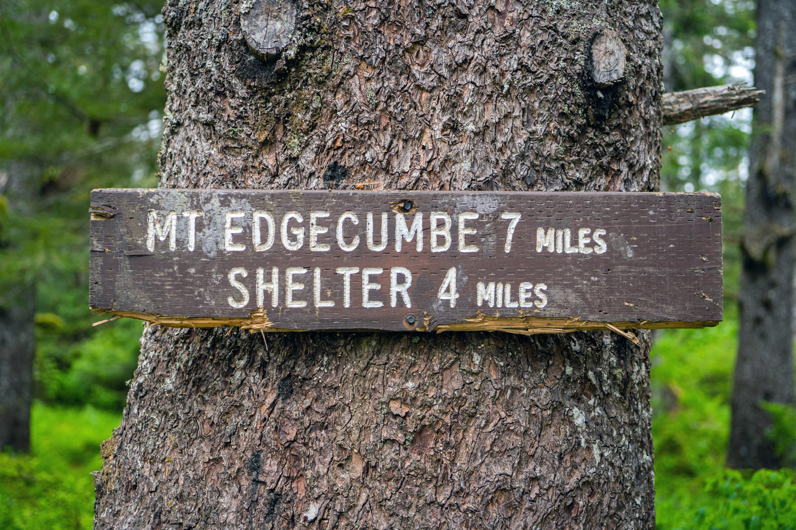
- TRAILHEAD : Trail begins 50 yards from Fred’s Creek cabin and ends at summit crater of Mt. Edgecumbe
- ELEVATION GAIN : 3,200 feet
- RECOMMENDED SEASON: Mid spring through fall
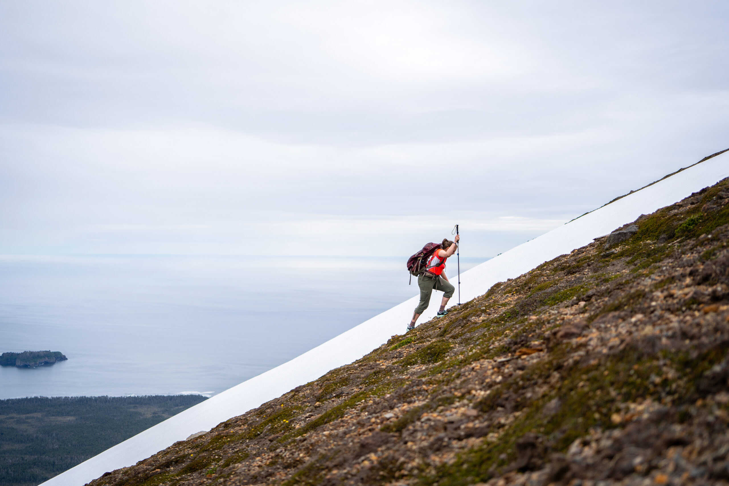
- LEVEL OF DIFFICULTY : Difficult. Muddy and wet in places. Last 3 miles steep climb. Last mile above tree line is extremely steep and on loose pumice. The route is marked with poles. The last mile is almost always windy and often has reduced visibility. Bears may be present.
- TRAIL MANAGEMENT AGENCY: US Forest Service

ACCESS
The trailhead is about 50 yards from Fred’s Creek cabin on the southeastern shore of Kruzof Island, about 10 miles west of Sitka. Accessible by boat, roughly half an hour skiff ride from Sitka. Sea Taxis can be hired for drop off and pickup. Overnight accommodations available at the Fred’s Creek cabin if reserved in advance at recreation.gov.
HISTORY
This trail was constructed in the early 1930’s by the Civilian Conservation Corps to provide recreational access to the summit of Mt. Edgecumbe, and recent upgrades have reduced the muddiness of the hike.
SPECIAL FEATURES
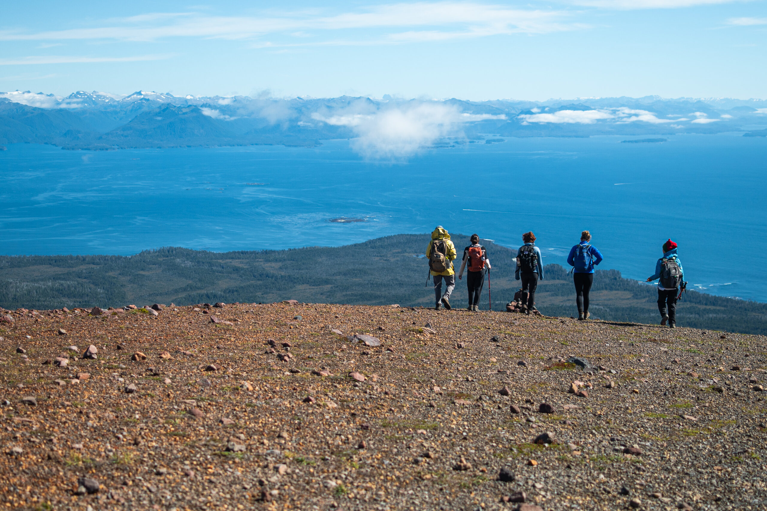
This National Recreation Trail leads to the top of Mount Edgecumbe volcano, although the last portion is marked only by posts. The vista from the summit is spectacular on a clear day.
DESCRIPTION
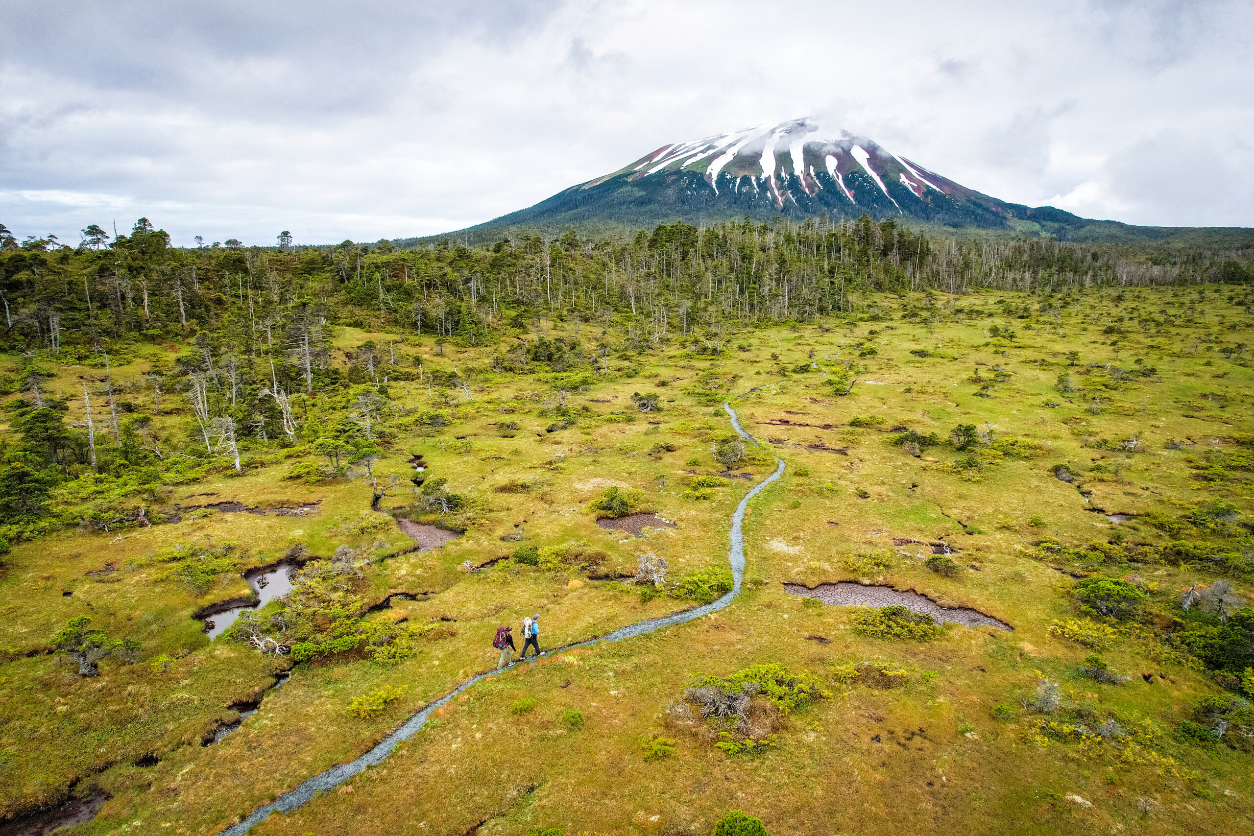
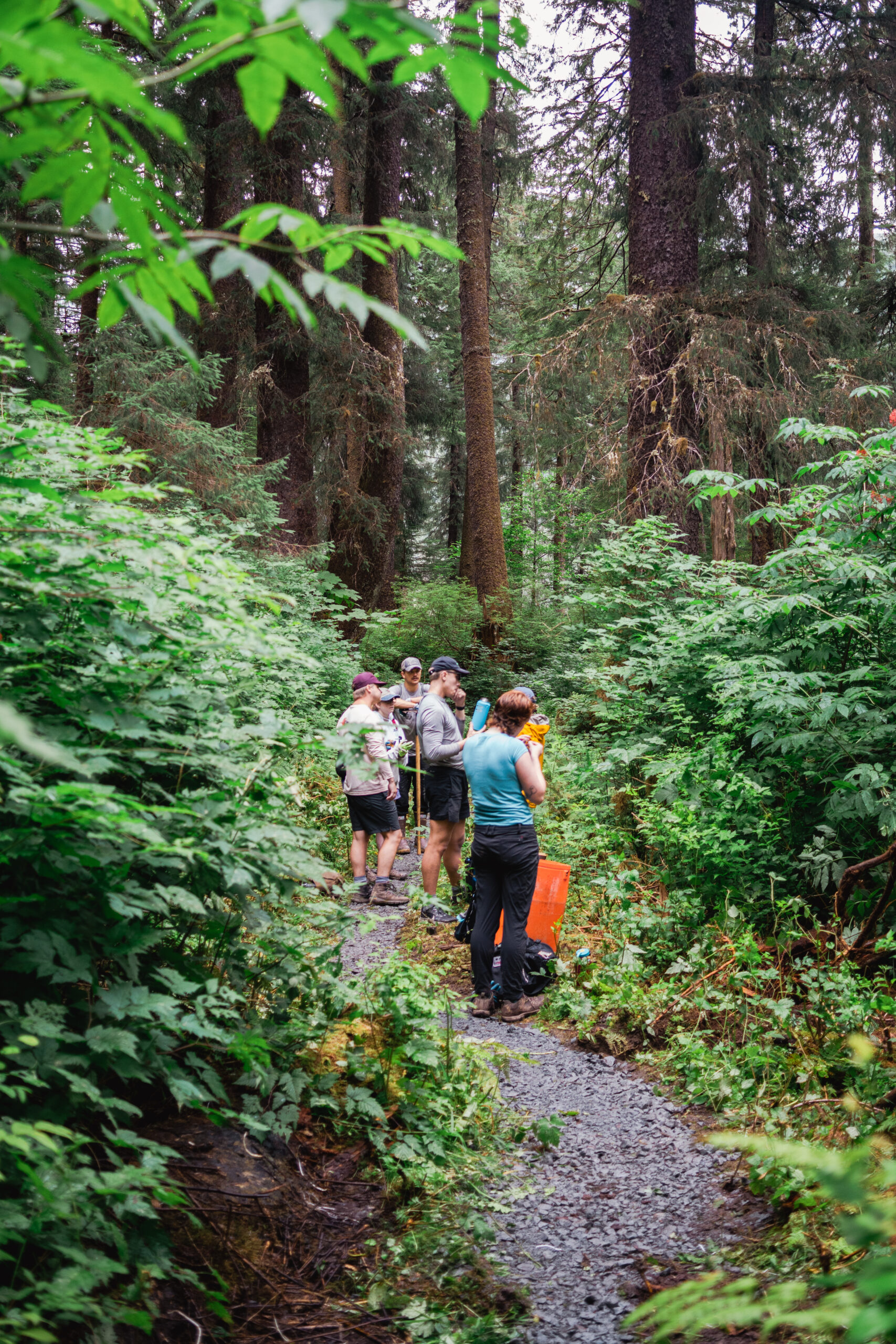
The trail begins about 50 yards from Fred’s Creek cabin in the big spruce trees. It gradually rises while running through several miles of muskeg alternating with forest nearly due west. About four miles up the trail, at an elevation of 700 feet, a spur trail leads to a three-sided shelter.
The trail steepens considerably as it climbs the mountain’s flank. The timberline is reached at about 2,000 feet and the trail ends here. Above this, the ground is covered by red volcanic ash, pumice and fragile vegetation. To reach the crater rim, follow the white trail posts.
CAUTIONS
Weather can turn inclement even in the summer. The summit is almost always windy and clouds can blow in at any time and reduce visibility. Take a change of clothes and windproof garments so you can stay warm and enjoy the rim trail. On a sunny or “hot” summer day, be sure to bring enough water or a water purifier to refill water bottles. The streams dry up in the summer and are hard to find.
Other Sources
http://www.summitpost.org/mount-edgecumbe-trail/429362
http://www.alaska.org/detail/mt.-edgecumbe-trail
http://alaska.ustrails.org/trails/Mt-Edgecumbe.html
http://www.fs.usda.gov/recarea/tongass/recreation/hiking/recarea/?recid=80291&actid=50